CJR Escalante Adventure 2005 – Maps
This is the maps index page. Understanding the topographic maps (the green ones) requires a little knowledge; this is best obtained by practice in the field, but here is a page and another page on how-to.
Sources for the maps: unless otherwise noted, these are topographic maps published by the United States Geological Survey (USGS) and obtained electronically via Microsoft TerraServer [apparently defunct as of March 2014]. I added routes and annotations using Viking and The GIMP.
You may be wondering, “how far did you hike?” This question isn’t as easy to answer as it might seem at first glance. A solid lower bound is 41 miles of backpacking and 46 miles of dayhiking; these are the numbers Viking reports for the total distance of the tracks I drew (by copying my paper notes, incidentally, not by GPS). However, each of these tracks is a sequence of line segments on the order of 50 or 100 yards long -- our actual route was much, much more windy than this. If we knew the tortuosity of each segment, i.e. the ratio between the actual distance traveled and the distance along the drawn routes, we could estimate our actual distance. Charles says this ratio runs about 1.3-2.0 in proteins, but we have no numbers for hiking. Short answer: we have no idea. ;)
![[maps/utah.png]](maps/utah.png)
|
Our general location in Utah.
Base map
from Google Maps. |
![[maps/utah-zoom.png]](maps/utah-zoom.png)
|
Overview of our trip in relation to Boulder and Escalante.
Base map from Utah Department of Transportation. |
![[maps/topo.jpg]](maps/topo.jpg.medium)
|
Full annotated topo map of the entire backpacking portion of the trip (i.e. everything except for Day 4). This is the union of the daily annotated topos. (Warning: the full size version of this image is truly humongous, weighing in at 3,800 by 3,400 pixels.) |
Note: the rest of this page is useful as an index to the rest of the days, but is otherwise not terribly interesting. If you are reading sequentially, I suggest you proceed to Days 1-3 now.
![[maps/day04.jpg]](maps/day04.jpg)
|
Day 4. Explore upper Middle Moody Canyon and look over the pass into Hall's Creek. Drive to Camp II. Dayhiking; May 20. full size (149k) |
![[maps/day05.jpg]](maps/day05.jpg.medium)
|
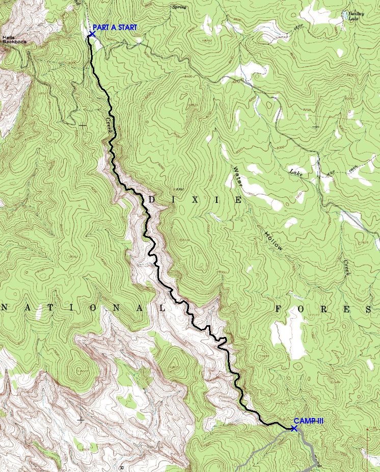
Day 5. First day of Part A. Hike down Sand Creek from Hell's Backbone Road to Camp III. Backpacking; May 21. |
![[maps/day06.jpg]](maps/day06.jpg)
|
Day 6. Climb west out of Sand Creek and over the ridge into the Right Fork of Death Hollow, to scout our planned route and make sure it exists. Dayhiking; May 22. full size (106k) |
![[maps/day07.jpg]](maps/day07.jpg)
|
Day 7. Hike from Camp III to Camp IV, i.e. over the ridge and down the Right Fork almost to the confluence with the main fork of Death Hollow. Backpacking; May 23. full size (119k) |
![[maps/day08.jpg]](maps/day08.jpg)
|
Day 8. Explore the narrows of Death Hollow. Dayhiking; May 24. full size (54k) |
![[maps/day09.jpg]](maps/day09.jpg)
|
Day 9. Hike from Camp IV down Death Hollow to Camp V in “Moonshadow Canyon”. Backpacking; May 25. full size (121k) |
![[maps/day10.jpg]](maps/day10.jpg)
|
Day 10. Explore “Moonshadow Canyon” and vicinity, including an overlook of our Day 9 route. Dayhiking; May 26. full size (121k) |
![[maps/day11.jpg]](maps/day11.jpg.medium)
|
Day 11. Hike down Death Hollow from Camp V to Camp VI in a fabulous alcove nearly at the Escalante River confluence. Backpacking; May 27. |
![[maps/day12.jpg]](maps/day12.jpg)
|
Day 12. Hike from Camp VI down to the very flooded Escalante River, then down the river a little ways and, via the Bowington Road, to Camp VII at the Sand Creek confluence. Backpacking; May 28. full size (129k) |
![[maps/day13.jpg]](maps/day13.jpg)
|
Day 13. Explore the high country across the river from camp. Help two young women find their way out of the canyon. Dayhiking; May 29. full size (91k) |
![[maps/day14a.jpg]](maps/day14a.jpg)
|
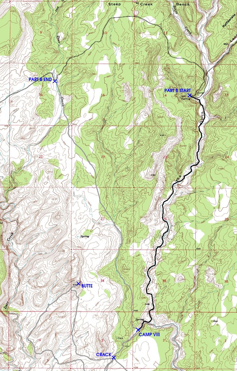
Day 14 (Part A portion). Hike from Camp VI to the end of Part A via an overland bypass. Drive to The Gulch trailhead and begin Part B by hiking in to meet the Mountaineers at Camp VIII. Backpacking; May 30. full size (91k) |
![[maps/day14b.jpg]](maps/day14b.jpg.medium)
|
Day 14 (Part B portion). Hike from Camp VI to the end of Part A via an overland bypass. Drive to The Gulch trailhead and begin Part B by hiking in to meet the Mountaineers at Camp VIII. Backpacking; May 30. |
![[maps/day15.jpg]](maps/day15.jpg.medium)
|
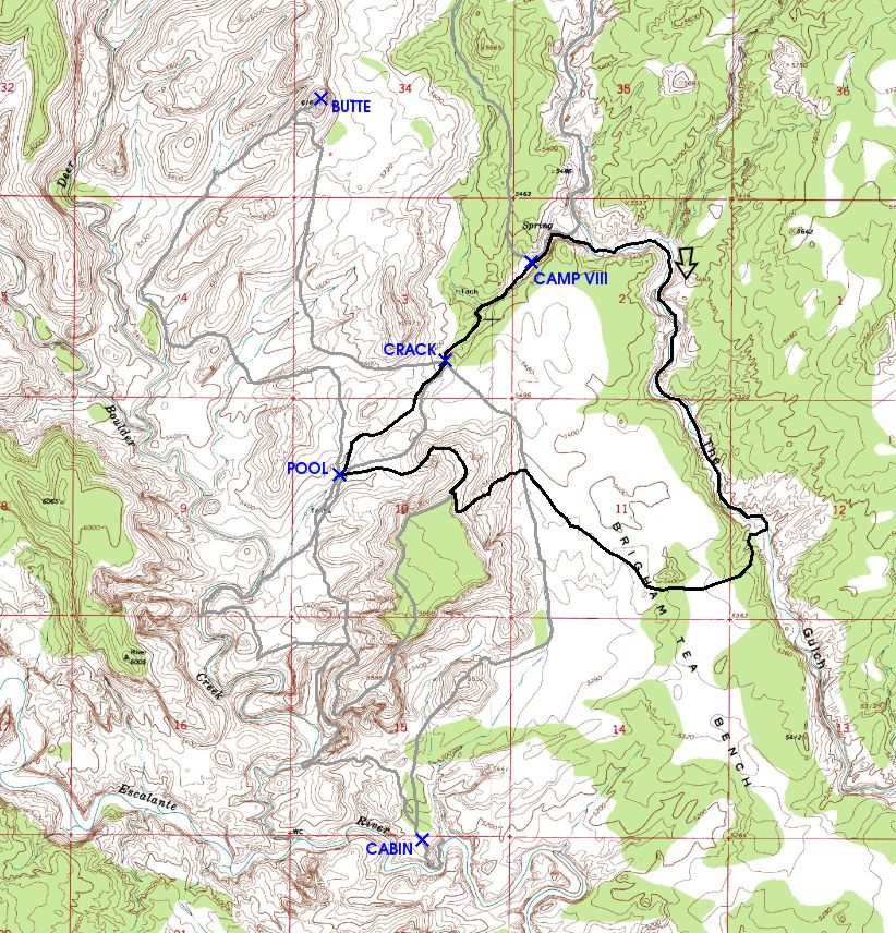
Day 15. Explore near The Gulch. Dayhiking; May 31. |
![[maps/day16.jpg]](maps/day16.jpg.medium)
|
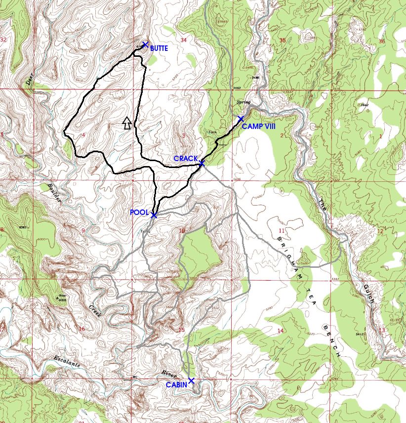
Day 16. Explore near The Gulch. Dayhiking; June 1. |
![[maps/day17.jpg]](maps/day17.jpg.medium)
|
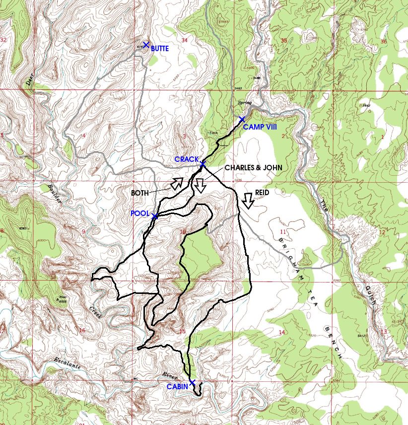
Day 17. Explore near The Gulch. Dayhiking; June 2. |
![[maps/day18.jpg]](maps/day18.jpg.medium)
|
Day 18. Flood! Heavy rains cause flood near camp. Hike out to Deer Creek trailhead. Backpacking; June 3. |
Please continue reading on Day 1.