CJR Escalante Adventure 2005 – Day 6
Synopsis: Climb west out of Sand Creek and over the ridge into the Right Fork of Death Hollow, to scout our planned route and make sure it exists. Dayhiking; May 22. View Day 6 route map.
Day 6 started out sunny and hot right away. Our plan was to bushwhack 1100 vertical feet from our camp to the top of the ridge dividing Sand Creek and the Right Fork of Death Hollow, then (hopefully) locate a route from the top to the floor of the Right Fork, 1400 feet below.
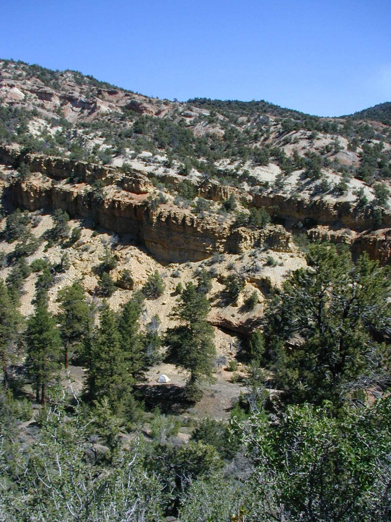
![[photos/rrp/p5220052.jpg]](photos/rrp/p5220052.jpg.medium)
|
Morning in Camp III. |
We had a fine alpine start and were on trail at 10:30 am. We jumped the creek, and the climb up through a pinyon-juniper forest was steep but straightforward.
![[photos/rrp/p5220055.jpg]](photos/rrp/p5220055.jpg.medium)
|
Camp III from 200 feet up the ridge. You can see our (tiny) tent below the ponderosas in the middleground. |
The top was a flat, relative featureless continuation of the forest. We took a compass bearing and found our way to the high point, then began our descent over very steep mixed talus and pinon-juniper. Halfway down was a wide bench, which the forest spilled across and over. This is where we got lost. We figured out later that sometime after leaving the top of the ridge, a large fault passed out of our view and we confused it with a different, smaller crack. However, for most of the day, we were basically lost.
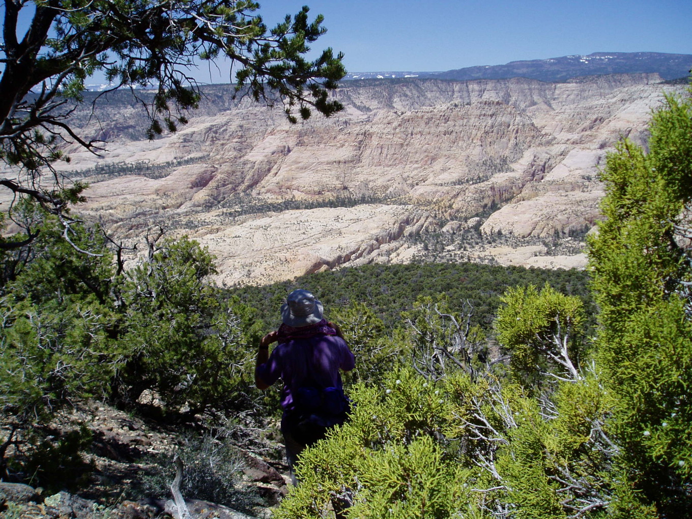
![[photos/cby/escalante_cby_027.jpg]](photos/cby/escalante_cby_027.jpg.medium)
|
Me trying to figure out where the hell we are. You can see the forested bench below us and the gaping sandstone bowl of the Right Fork. Our eventual route down went through the crack to the right of the two small lumps in the right-center of the photo.
Photo by Charles Yeamans. |
Even with a huge view of nearly the whole drainage, nothing matched the map. We couldn’t identify the path of the main drainage, or, for that matter, any way in which it was remotely possible for water to drain out of the bowl. Eventually we pretty much winged it; we could see an area that seemed likely to lead to the bottom of what was apparently the main wash, so we headed for it.
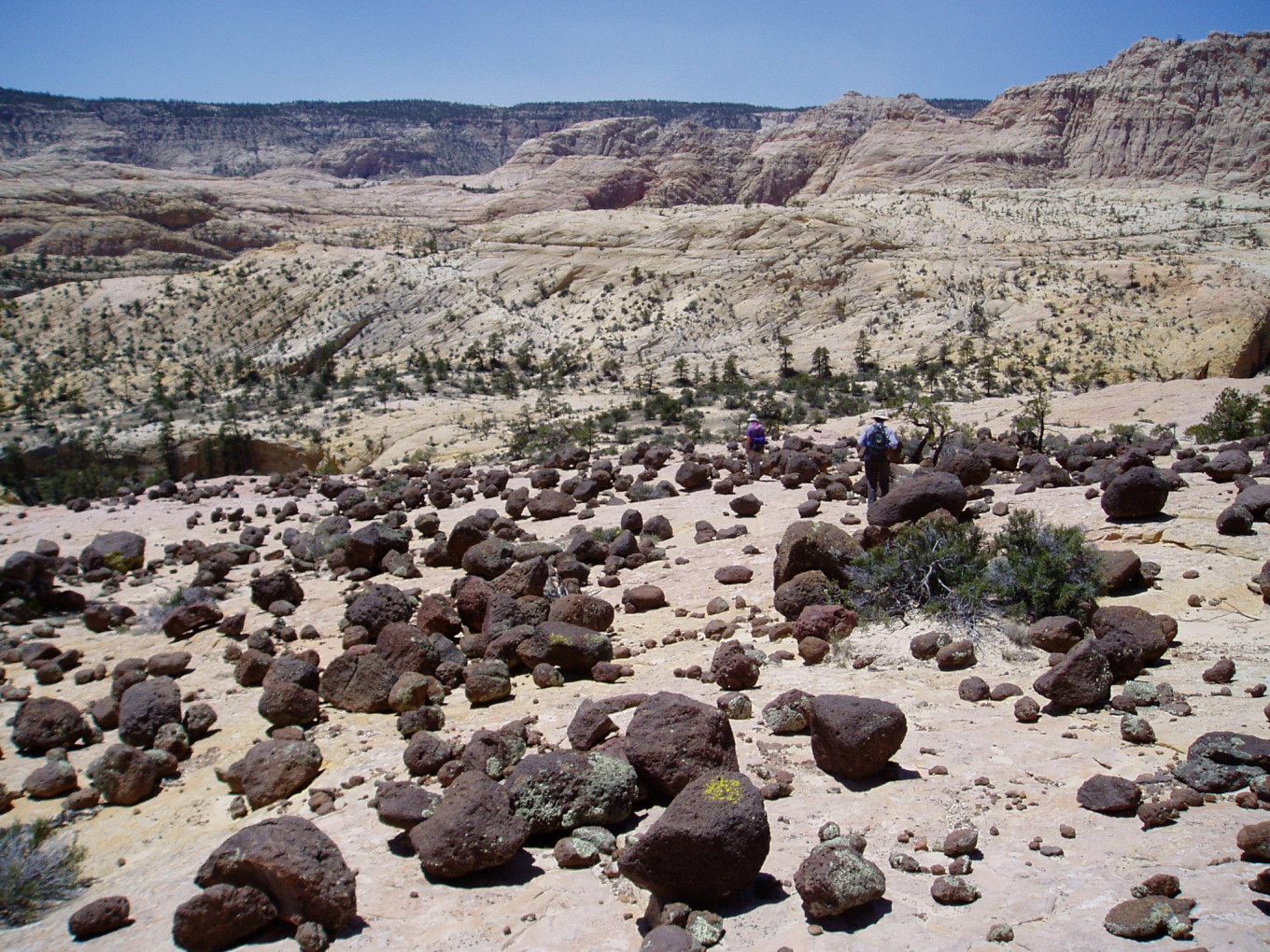
We made our way over the bench and down a second slope, forested at first but increasingly broken by large areas of white sandstone. Some of these sandstone areas were covered with scattered black igneous rocks, round and precariously perched. The angle was such that these rocks would not have stopped where they were had they rolled down from above, so they must have been slowly lowered as the sandstone eroded.
![[photos/cby/escalante_cby_029.jpg]](photos/cby/escalante_cby_029.jpg.medium)
|
John and me hiking through one of the rock gardens. There were others, much steeper, that had a similar distribution of black rocks.
Photo by Charles Yeamans. |
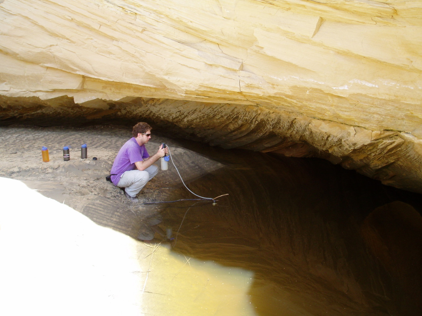
After reaching the rim of the inner canyon, the last 50 feet were the hardest part, as we had expected. It was very hot out on the slickrock. We speculated on how long a person in heavy winter gear standing out in this weather would remain conscious. After a couple of dead ends, we found a way down through a crack. The last few vertical feet were a pouroff, but a narrow ledge and a couple of steps (Class 3+) led to the bottom, and directly around the corner was shady alcove and a pool — perfect for lunch.
![[photos/cby/escalante_cby_030.jpg]](photos/cby/escalante_cby_030.jpg.medium)
|
Me pumping water in the lunch alcove.
Photo by Charles Yeamans. |
Following lunch, we hiked down the sandy, twisting canyon bed. The walls were sheer yellow sandstone, perhaps 60 or 80 feet high. We passed one potential way out on the east side, and then another, 45 minutes downcanyon from lunch. Here we climbed out into the huge slickrock bowl of the Right Fork, picking our way from ledge to ledge over the undulating Navajo Sandstone.
We reached the foot of the main cliffs separating the floor of the bowl from the forested ridgetop. A rounded sandstone ridge, shaped like a loaf of bread and checkerboarded by small cracks, was angled gently enough that we could follow it up to the easier slopes above.
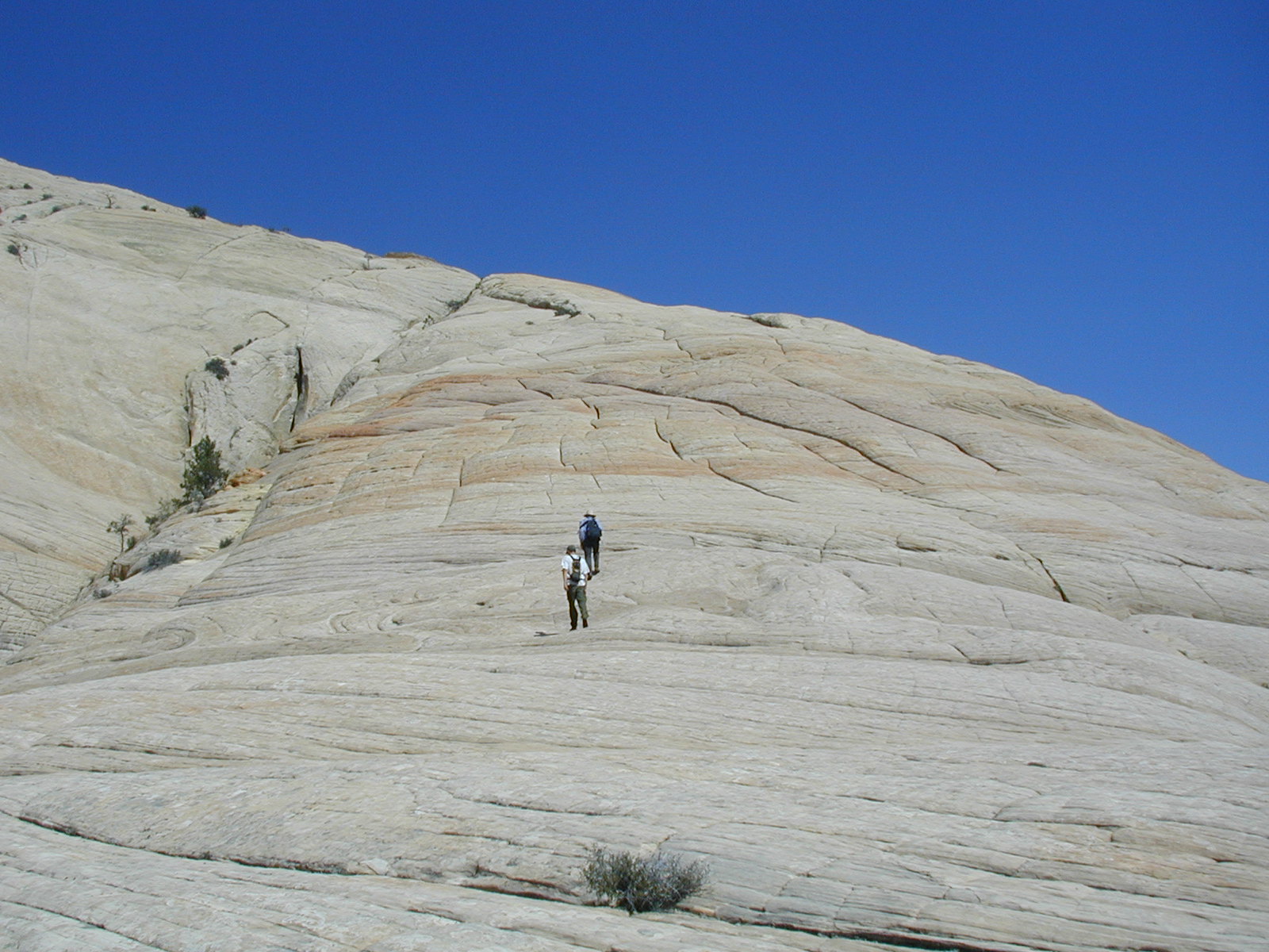
![[photos/rrp/p5220057.jpg]](photos/rrp/p5220057.jpg.medium)
|
Charles and John climbing the loaf of bread. |
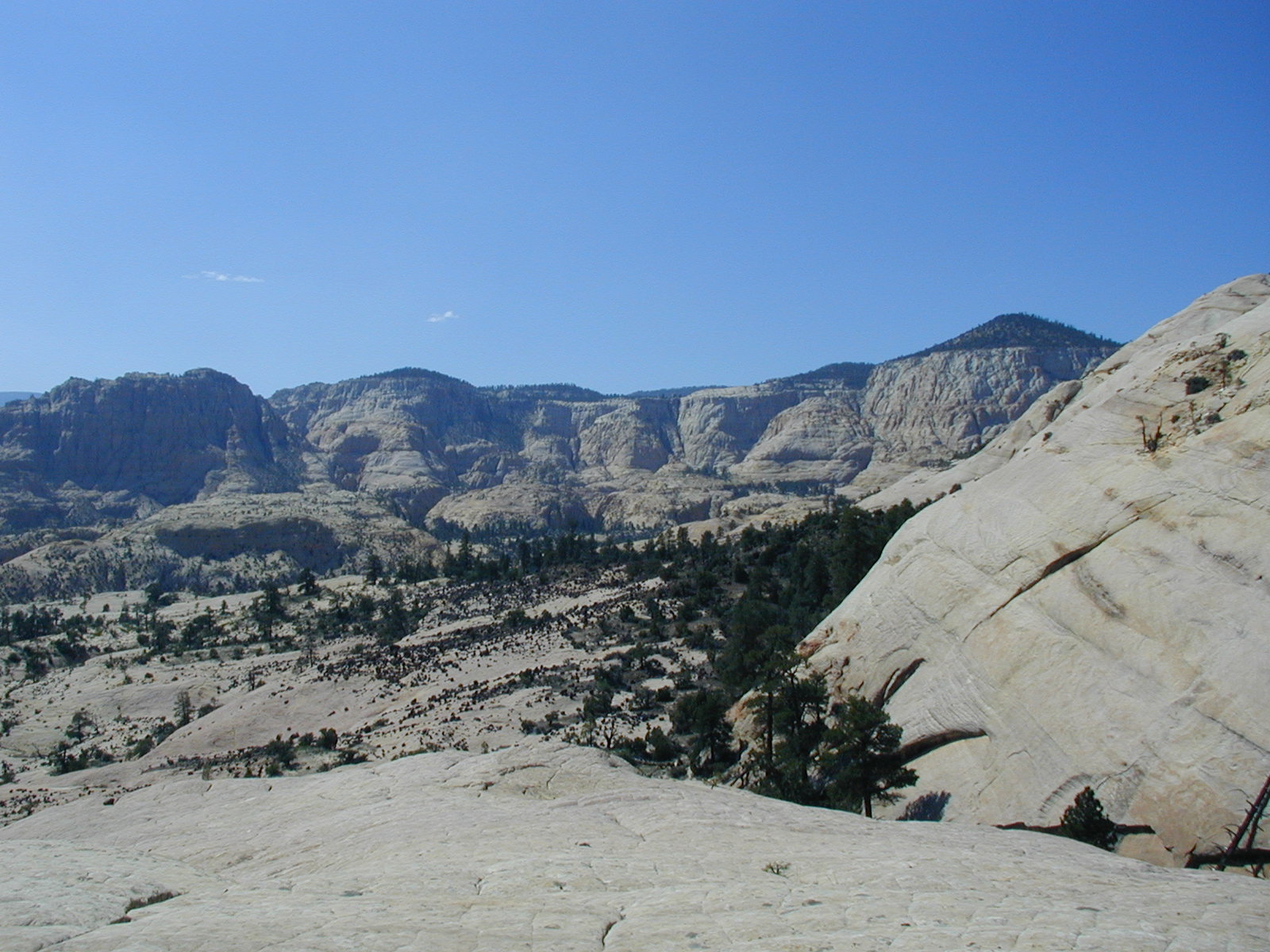
![[photos/rrp/p5220058.jpg]](photos/rrp/p5220058.jpg.medium)
|
Looking north into the bowl of the Right Fork. |
“Easier” meaning only “less steep on average”, of course. We had to carefully pick our way through the rock slopes. Sandstone like this is a surreal, eerie place to be. Nowhere along our route was the objective danger more than minimal. But the eye plays tricks on you. Some sections which were quite easy appeared from a distance to be impossibly, breathtakingly steep and precariously near to the yawning abyss.
It was a long, hot slog up the bare rock and then through the forest. On top of the ridge, we were, of course, still lost.
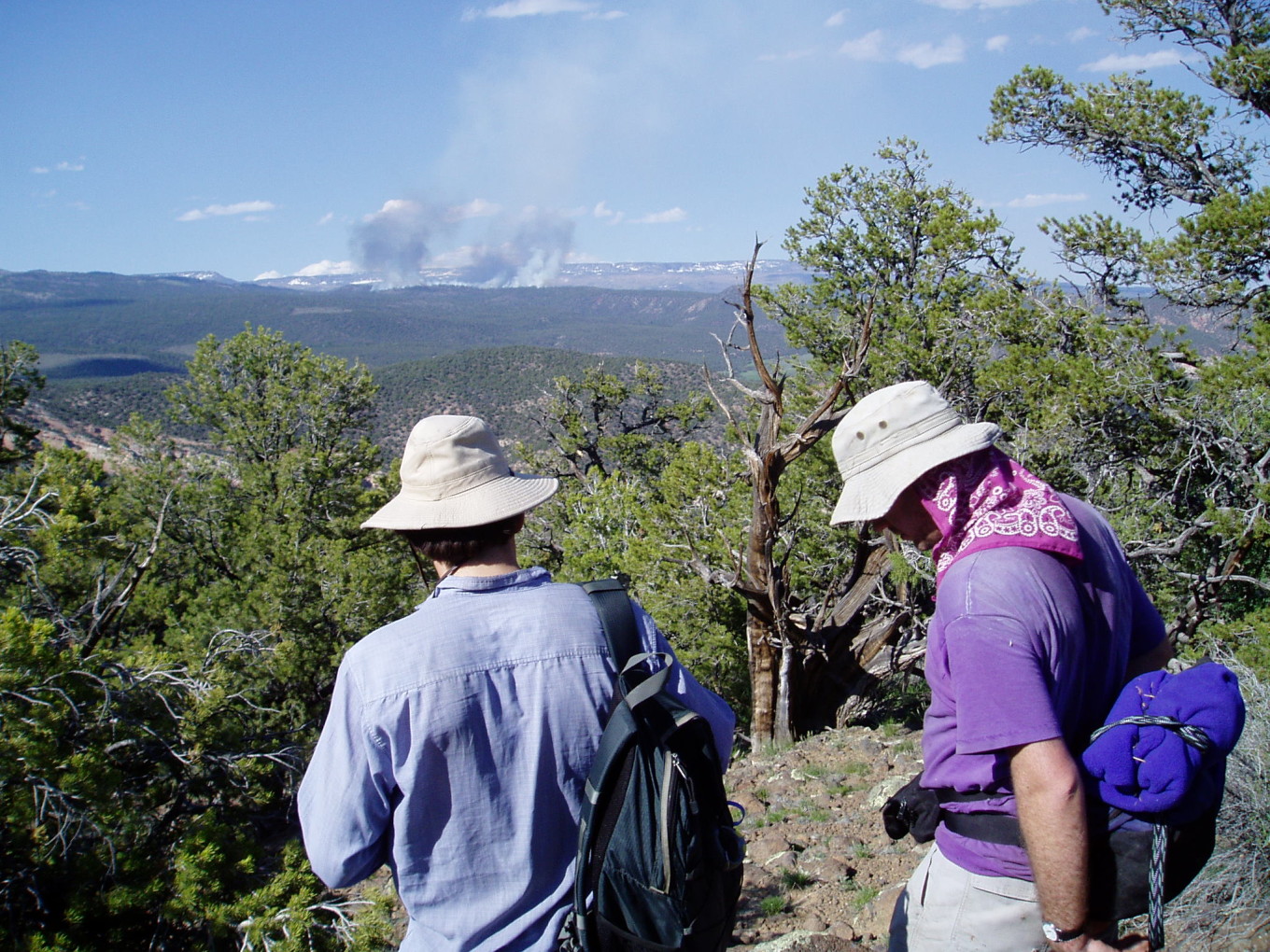
![[photos/cby/escalante_cby_032.jpg]](photos/cby/escalante_cby_032.jpg.medium)
|
John and me looking over the slopes back down into Sand Creek. A prescribed fire is burning on a far ridgetop.
Photo by Charles Yeamans. |
With continual debate as to where we were and where, precisely, we should head down, we followed a minor ridgeline down to Sand Creek. We reached the creek about half a mile downstream of camp, while we had expected to arrive within a stone’s throw.
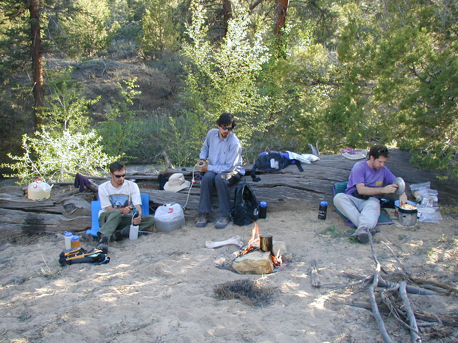
Back in camp, I cooked my famous enchiladas for supper.
![[photos/rrp/p5220063.jpg]](photos/rrp/p5220063.jpg.medium)
|
Mmmmmm, fresh cheese. |
![[photos/rrp/p5220064.jpg]](photos/rrp/p5220064.jpg.medium)
|
Me cooking while Charles and John pump water. Note how murky it is, even after settling all day. |
![[photos/rrp/p5220067.jpg]](photos/rrp/p5220067.jpg.medium)
|
The final extremely yummy product. |
Charles adds: Frequently, hummingbirds would chase each other through camp, fighting over the purple flowers and not really caring about the presence of the slow, ugly, ground-based birds. There was also much chasing and fighting in the trees above.
Please continue reading on Day 7.