CJR Escalante Adventure 2005 – Day 12
Synopsis: Hike from Camp VI down to the very flooded Escalante River, then down the river a little ways and, via the Bowington Road, to Camp VII at the Sand Creek confluence. Backpacking; May 28. View Day 12 route map.
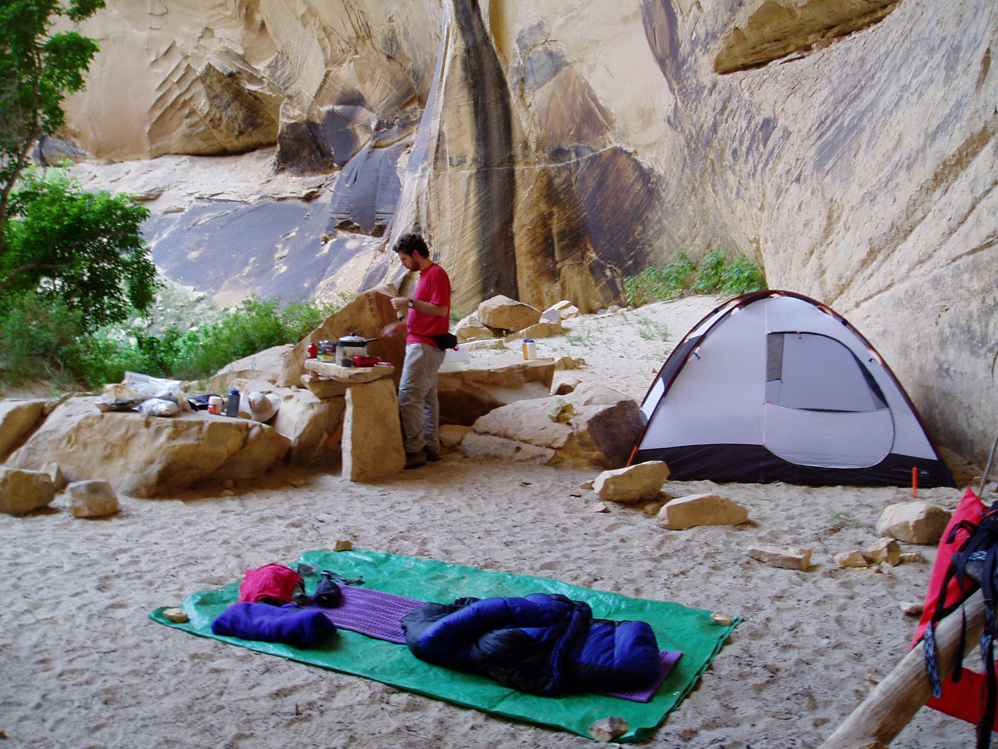
We started this day thinking it was going to be easy and short. I cooked hash browns with sausage (freeze-dried), and we loafed around and eventually got out of camp after 11:00 am.
![[photos/cby/escalante_cby_097.jpg]](photos/cby/escalante_cby_097.jpg.medium)
|
Me cooking breakfast peacefully in Camp VI.
Photo by Charles Yeamans |
However, this day was about water, and lots of it. Forty-five idyllic minutes down the canyon, we were greeted by the following:
![[photos/rrp/p5280172.jpg]](photos/rrp/p5280172.jpg.medium)
|
The Escalante River at the Death Hollow confluence. |
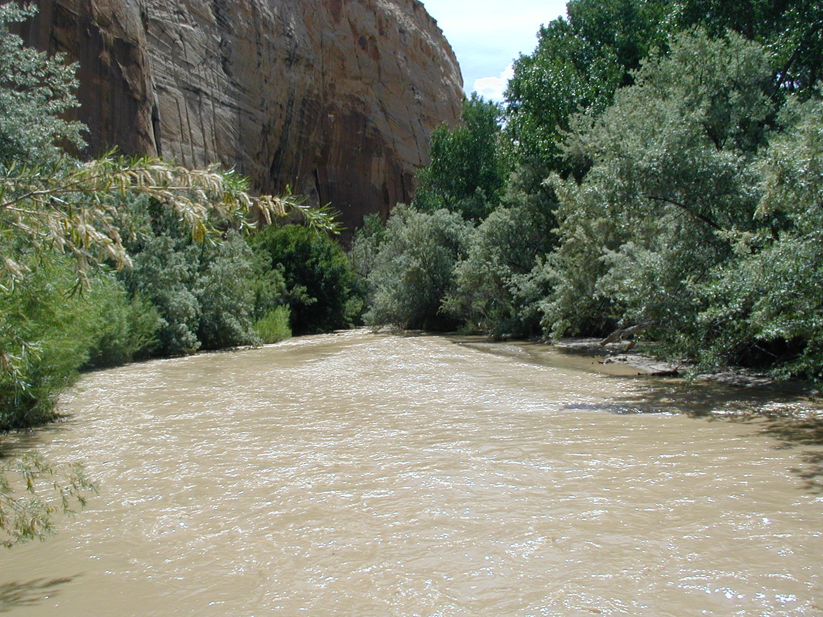
Let’s take a moment to talk about water. Observe this graph of Escalante River water levels:
![[Escalante River flow graph]](esc-flow.png)
The red line is normal, and the blue line is average daily flow for this year. Note first that typical flows this time of year are around 5-20 cubic feet per second (CFS). Also, when we were planning the trip, flows hadn’t exceeded 70 CFS — but by the time we arrived on the river, flows were in the 250 CFS range, i.e. a dozen-plus times more water than normal, and four times more than we were anticipating. Bottom line: we faced frequent, waist-deep crossings of swiftly moving muddy water in order to make any progress down the Escalante River canyon, our intended route.
The first crossing took the longest. We spent a good while scouting the near side of the river, and John took off his pack and waded across to scout the far side. There was clearly a major trail on the far side, and the near side was dense brush. After extensive debate, we decided to cross without packs, and to set up a zip line to slide the packs across above the water. This involved Charles climbing into a tree. Eventually (it probably took us around an hour to cross), all the packs were across, and we were across. We optimistically changed into our hiking boots, being under the impression that this was the only crossing until just before camp.
Of course, this was a ridiculous idea. The trail crossed the river again after only a few hundred yards. We changed back into sandals, and crossed the river, this time simply wading across with our packs on. Thus the wade, thrash, wade cycle began — the trail had a tendency to fade out and leave us in dense brush, and if the brush didn’t force us across the river, the sandstone cliffs did.
The crossings were difficult and finicky, but we got better at it as the day wore on. The objective danger was acceptable — a swimmer would have no trouble reaching the bank — but the danger to our gear was very real, as falling in would likely require the hiker to immediately ditch his pack. It was slow going; the 3/4 mile along the river that we did cover took over three hours (Charles estimates that we crossed eight times). We decided to take the first escape route available, a route up a side canyon which met the Bowington Road, a trail which we could follow to our planned camp near where Sand Creek entered the Escalante River. This involved an extra 700 feet of elevation gain and loss, but that would be a cakewalk compared to another 3 miles of river.
![[photos/rrp/p5280174_enhanced.jpg]](photos/rrp/p5280174_enhanced.jpg.medium)
|
The Bowington Road. The red cliffs mark the far side of the Escalante River canyon. |
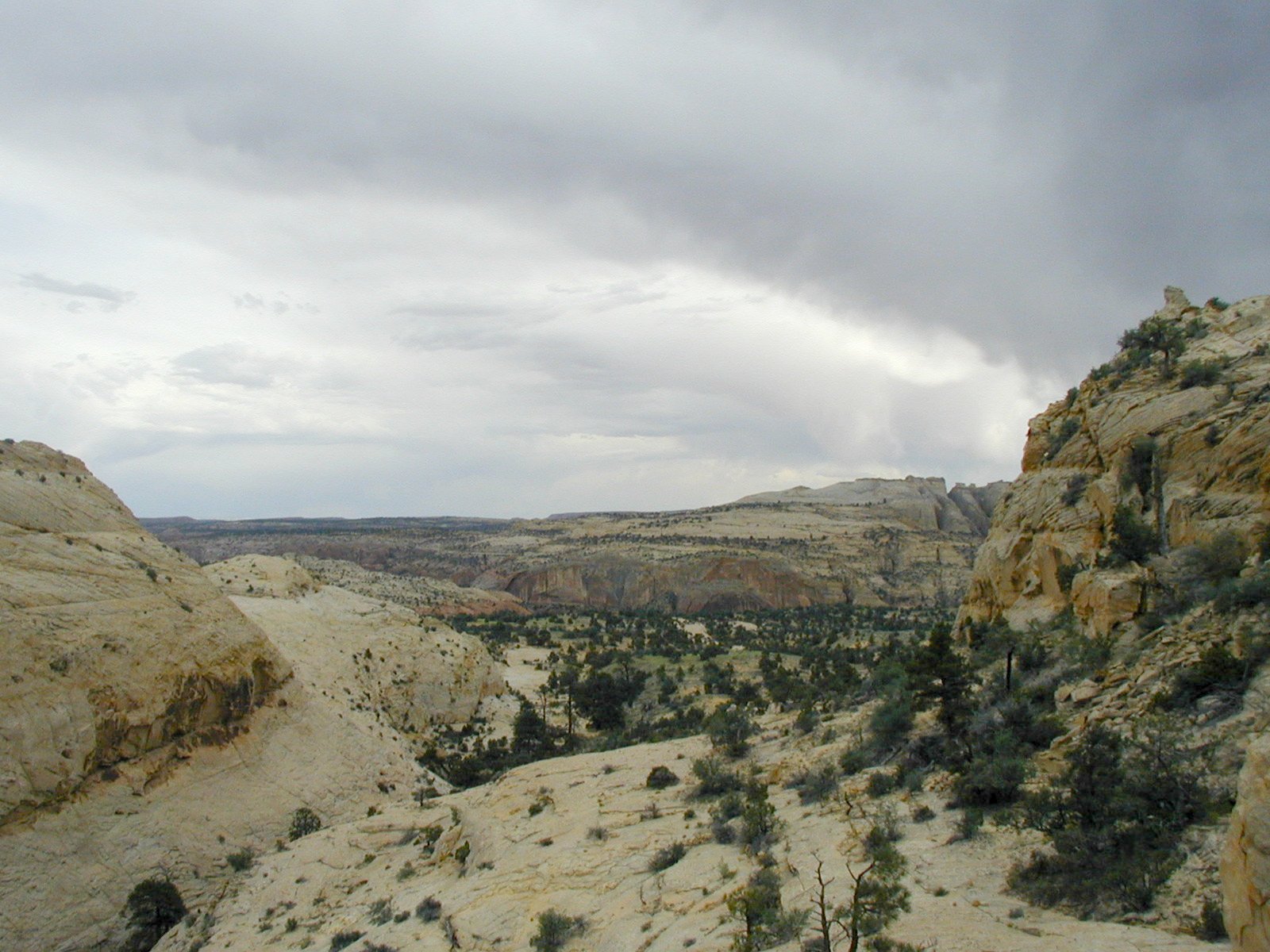
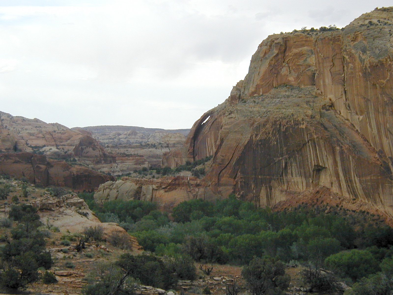
The weather had again turned threatening, and occasional drops spattered the ground as the clouds roiled and thundered. Finally, the trail descended the last few cliffs and we were on the floodplain of the Escalante River. We scouted for a camp and didn’t find any established sites; there were plenty of possibilities, but the mosquitoes were out in force in the humid, still river-bottom air and we elected to wearily climb back out to a ridgetop site we’d seen atop the final cliffs, 100 feet or so above the bottom.
![[photos/rrp/p5280179_enhanced.jpg]](photos/rrp/p5280179_enhanced.jpg.medium)
|
Unnamed natural arch, looking from the Bowington Road just before it descended to the floodplain. The next day, we found a route to the top of this cliff. |
We were exhausted. Charles and I made a water run and fetched five gallons of very muddy river water. We were all kind of crabby, and the wind which had kicked up did not help matters (we had to put on the extra wind tie-downs on the tent and move all the necessary rocks to tie them to, as there was no place to put in stakes). I cooked rice and beans for supper.
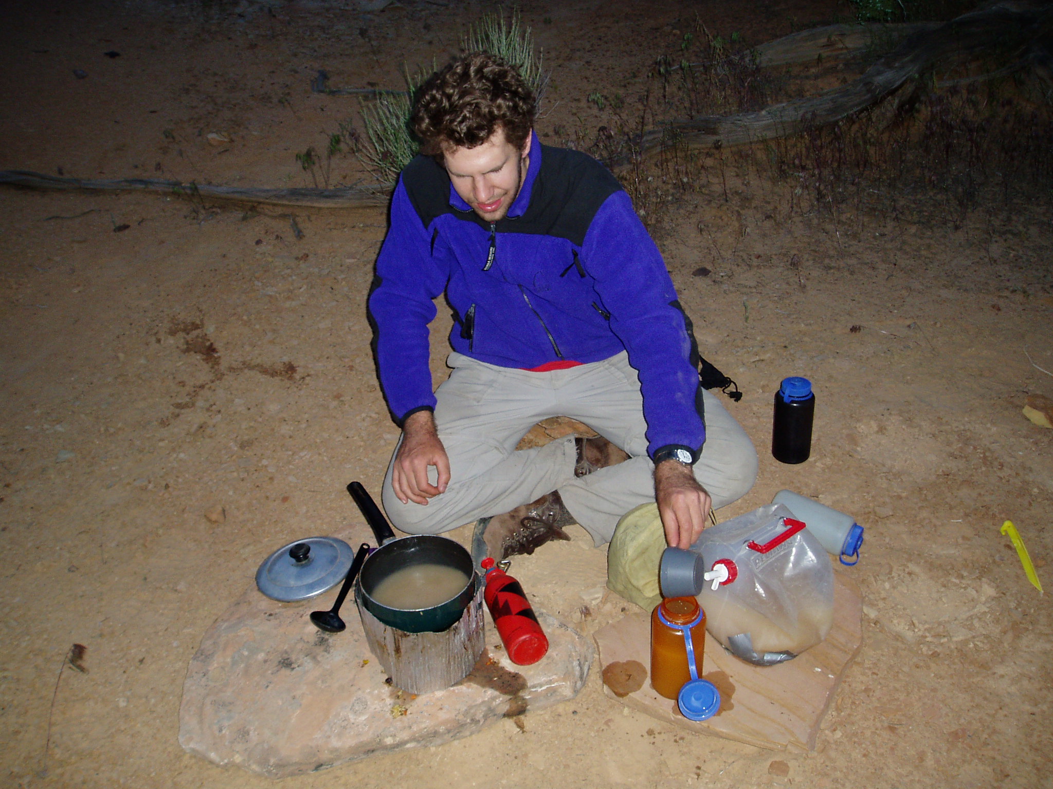
![[photos/cby/escalante_cby_106.jpg]](photos/cby/escalante_cby_106.jpg.medium)
|
Me boiling water to purify it, to spare the filters. With Sand Creek (settled) and pothole water, the filters lasted two or three liters between cleanings, and with Death Hollow water a dozen or more. Escalante River water, unsettled: one liter at best. Each cleaning wore out the filter cartridge a little more, so I used our abundant fuel to boil three liters. In the morning, each liter had about a quarter inch of silt in the bottom. Settled river water got us two liters per cleaning or so. |
My sleeping bag felt very, very good.
Please continue reading on Day 13.