CJR Escalante Adventure 2005 – Day 16
Synopsis: Explore near The Gulch. Dayhiking; June 1. View Day 16 route map.
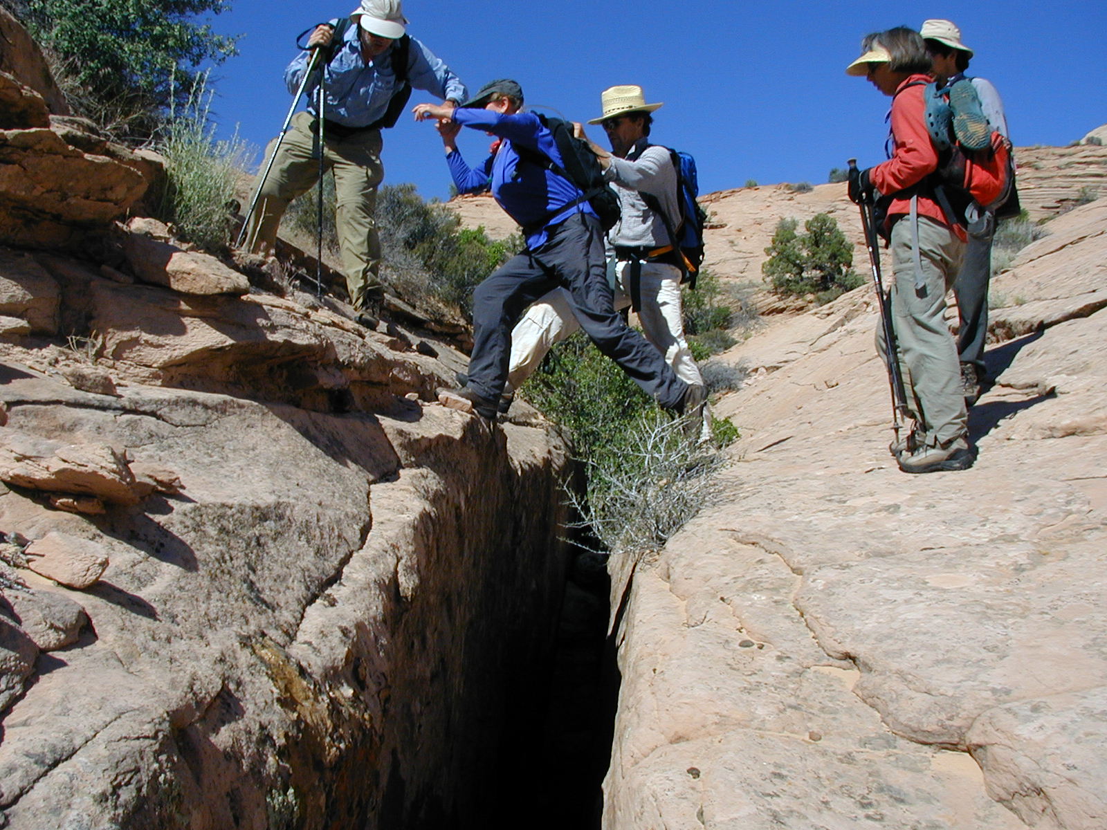
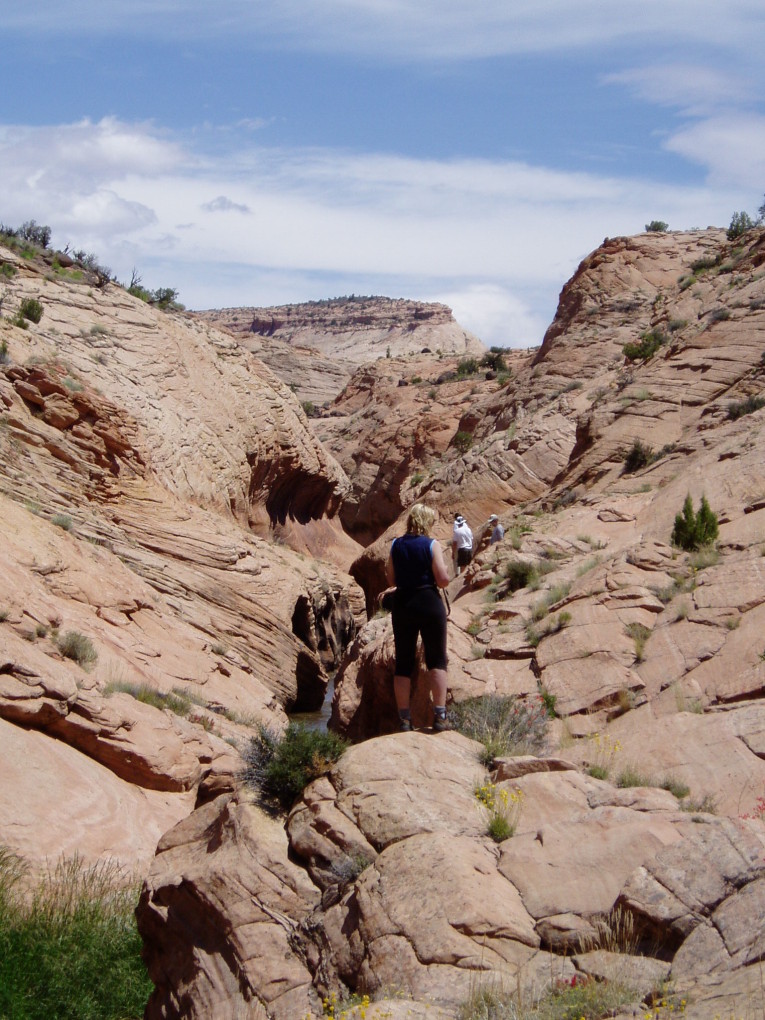
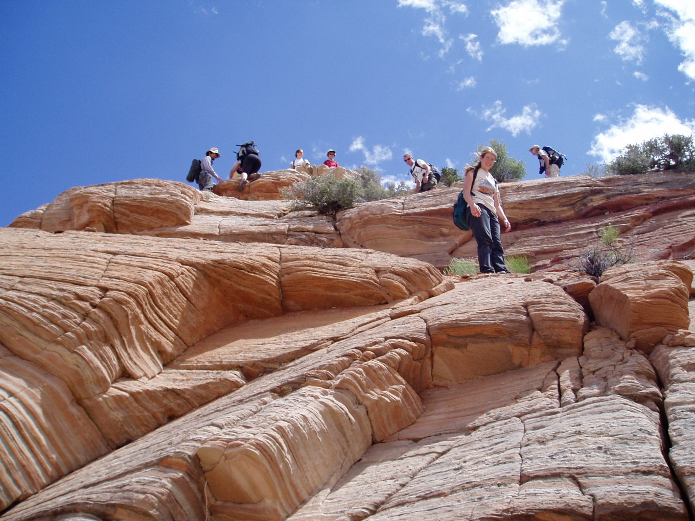
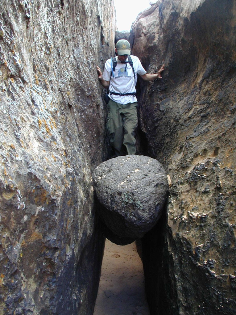
We left camp at 9:30 and headed up the side canyon, towards the crack. While crossing the crack, we were overtaken by the Scudders and some other folks from the other party — it looked for a while that it was going to be a 17-person dayhike, quite a crowd.
![[photos/rrp/p6010228.jpg]](photos/rrp/p6010228.jpg.medium)
|
Bill helping Jackie across the crack. Our daily route indeed required jumping over this crack, which was around 12 feet deep. |
![[photos/rrp/p6010232.jpg]](photos/rrp/p6010232.jpg.medium)
|
Ascending a slope after crossing the crack. |
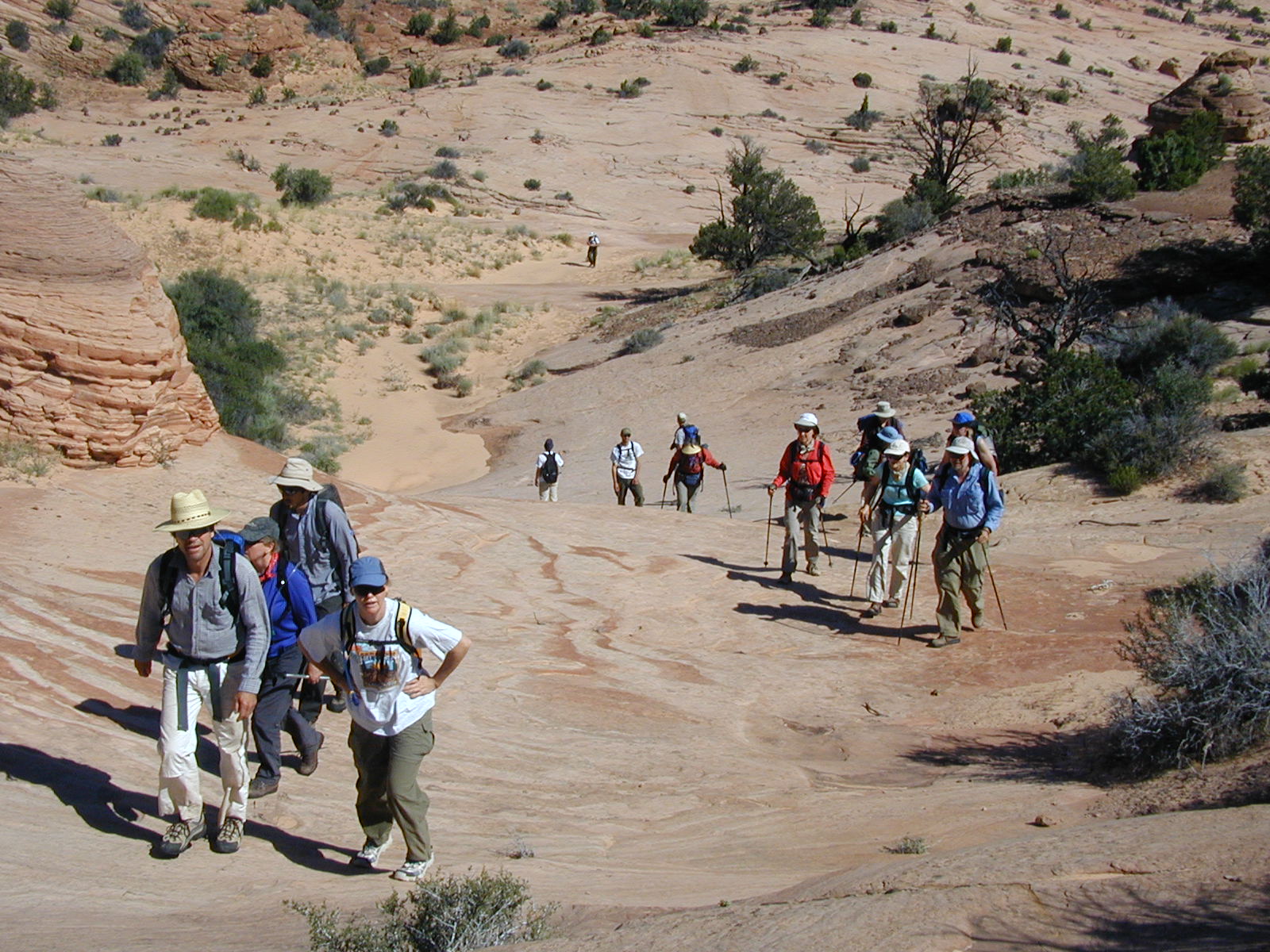
Shortly after the crack is where it gets interesting for you, the reader. The other party folks were headed to the Boulder Narrows, while we had been planning a circumnavigation of the mesa. We split; Charles, John, and several others of our party went with the Scudders to the Narrows while I stayed with the circumnavigators.
Reid’s dayhike
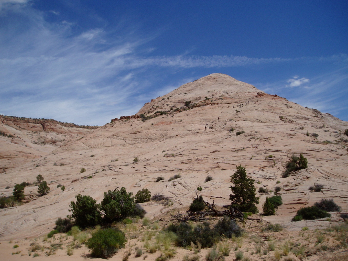
We skirted the base of the peninsula where we’d descended the previous day and followed a dry wash around the mesa. Tucked into a bay on the south side was a detached mound which rose 400 feet above the flats.
![[photos/wcp/p5250131.jpg]](photos/wcp/p5250131.jpg.medium)
|
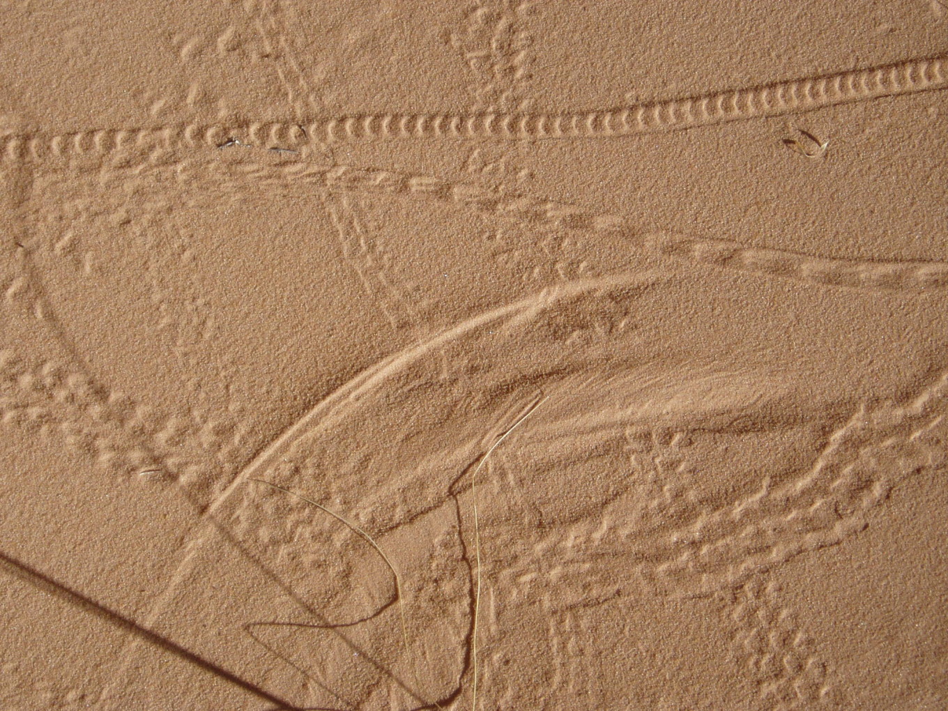
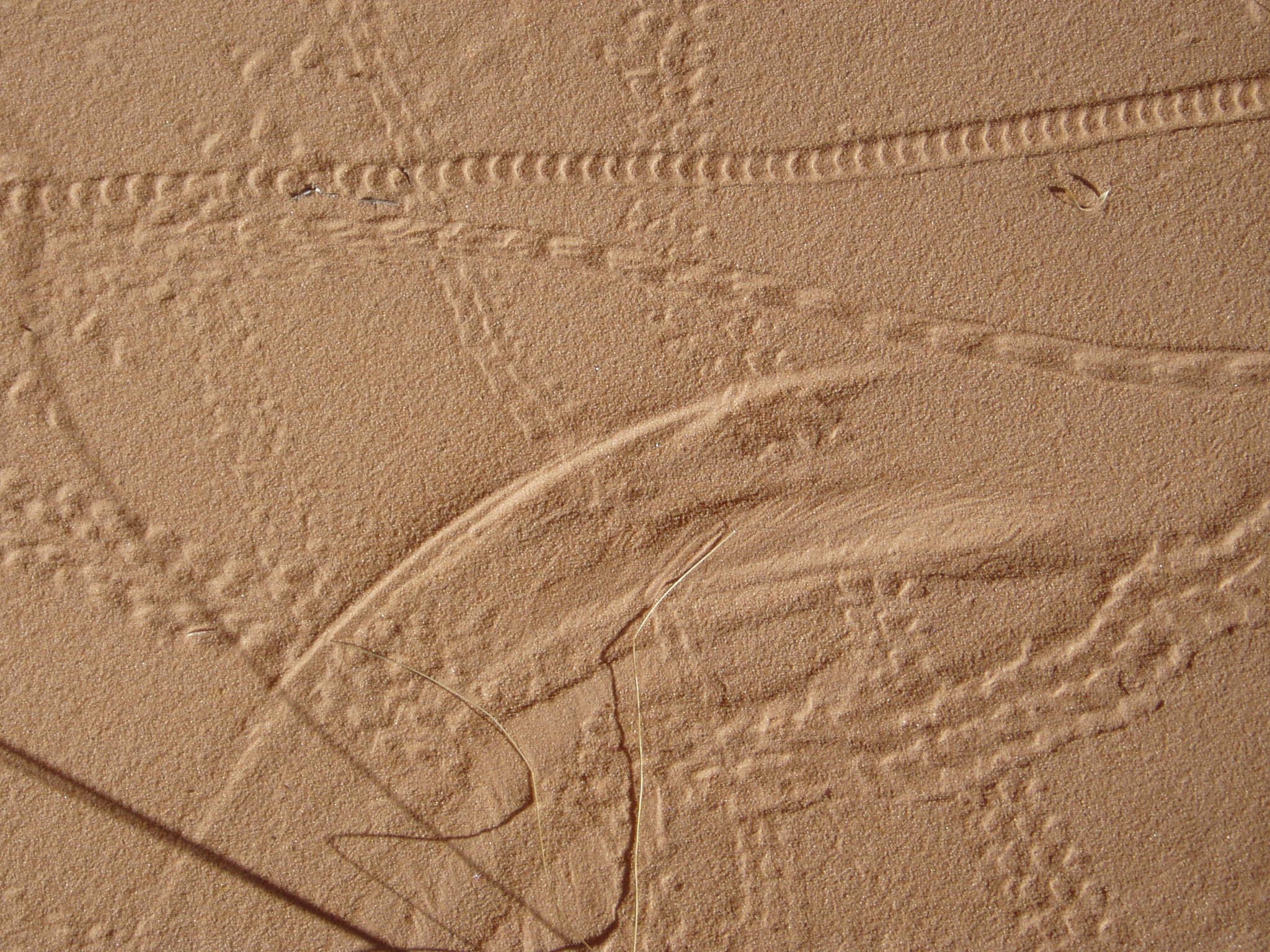
Insect tracks in the sand at the side of the wash. You can also see the marks made by the grass as it swings to and fro in the wind.
Photo by Bill Priedhorsky. |
![[photos/rrp/p6010233.jpg]](photos/rrp/p6010233.jpg.medium)
|
Lenticular clouds over The Gulch. |
We climbed the high-angle slickrock to the top of the mound (Class 3+ with spots of 4).
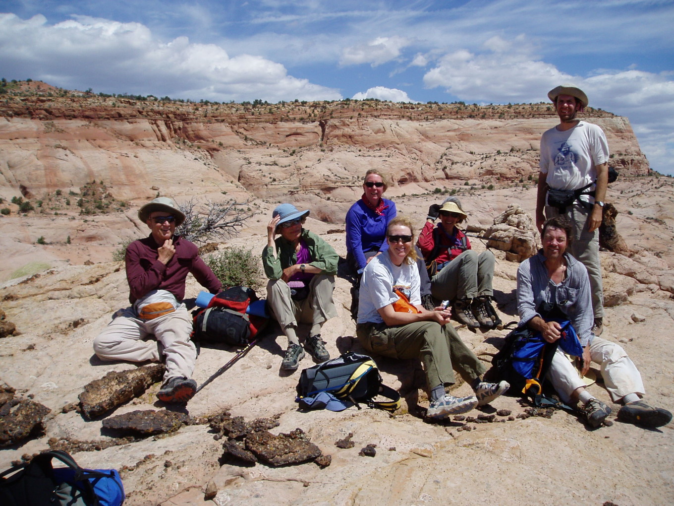
![[photos/wcp/p5250138.jpg]](photos/wcp/p5250138.jpg.medium)
|
The summit team. L-R: Mark, Lynne, Jackie (in blue), Jeri, Marilyn, Dave, Reid. Not pictured: Bill, Elizabeth Kelly. It was extremely windy on top. The main body of the mesa is visible in the background.
Photo by Bill Priedhorsky. |
![[photos/wcp/p5250139.jpg]](photos/wcp/p5250139.jpg.medium)
|
Descending the mound.
Photo by Bill
Priedhorsky. |
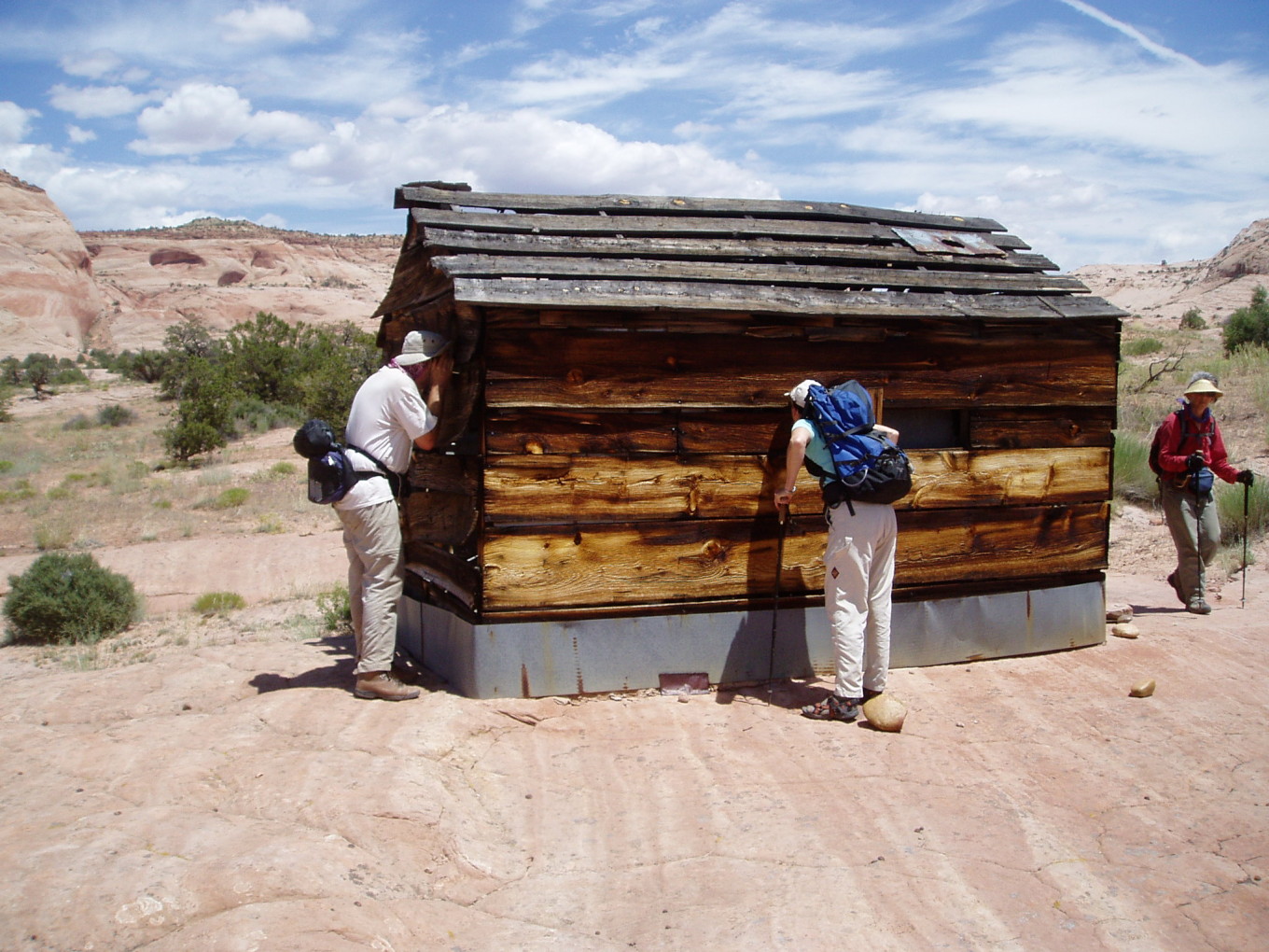
Once at the bottom of the mound, we hiked a half mile south to an old line cabin on the rim of the Escalante River canyon.
![[photos/wcp/p5250140.jpg]](photos/wcp/p5250140.jpg.medium)
|
Peering into the cabin.
Photo by
Bill Priedhorsky. |
![[photos/rrp/p6010234.jpg]](photos/rrp/p6010234.jpg.medium)
|
Cabin interior. Note the old iron bed and the hanging can lantern. |
![[photos/wcp/p5250141.jpg]](photos/wcp/p5250141.jpg.medium)
|
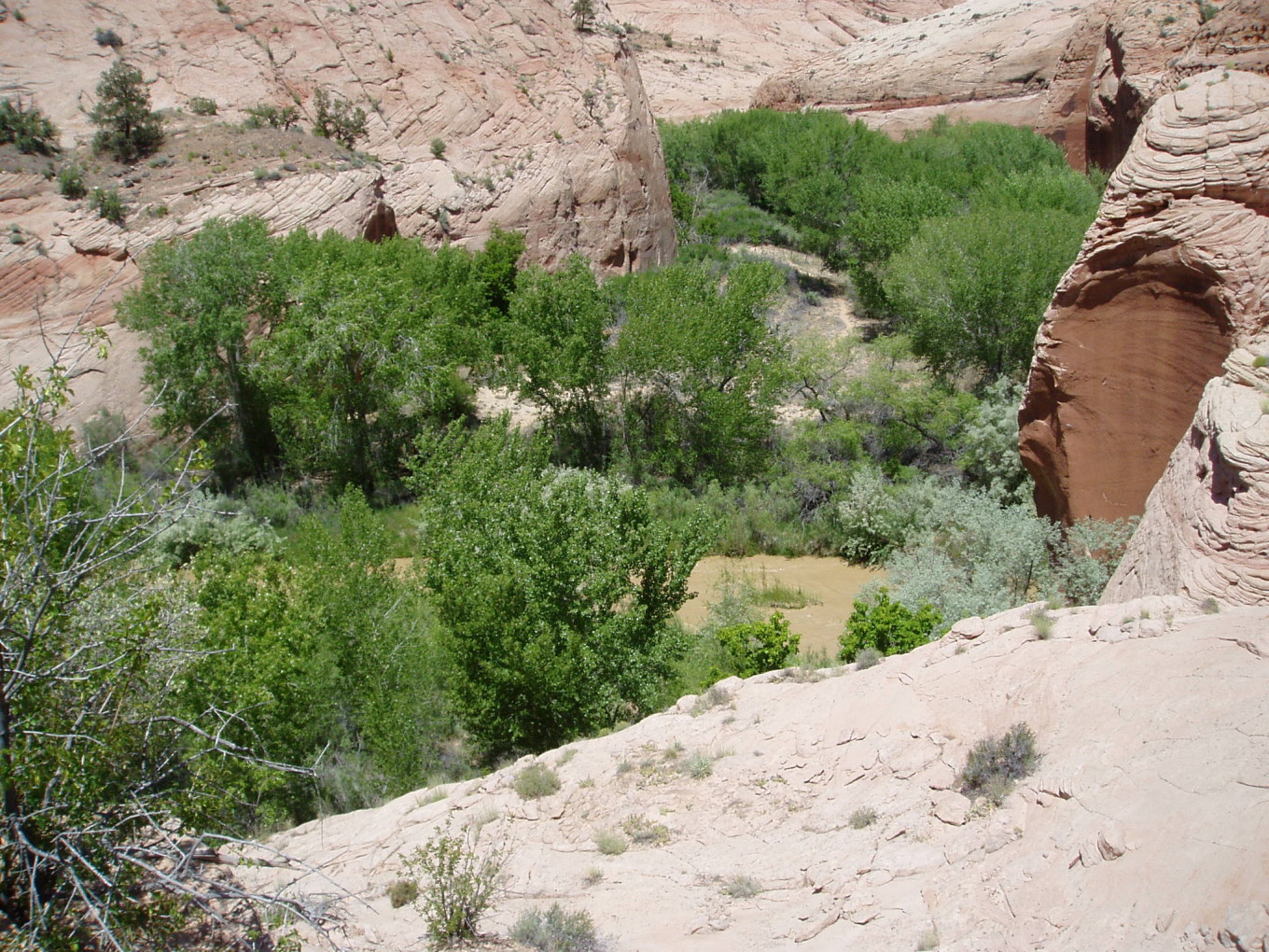
The Escalante River from near the cabin. It was running about 400 CFS at this point below Boulder Creek.
Photo by
Bill Priedhorsky. |
We descended to the river on a trail and located a shady cliff under which to have lunch.
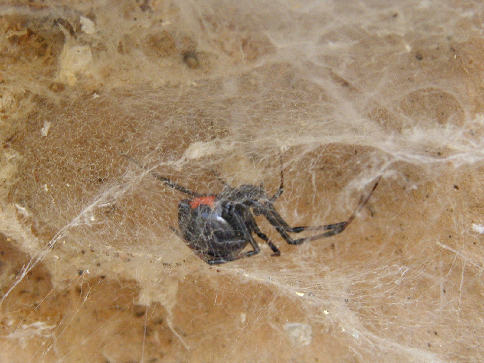
![[photos/rrp/p6010237.jpg]](photos/rrp/p6010237.jpg.medium)
|
A large black widow spider which guarded the way to lunch. Her body is about the size of a dime. |
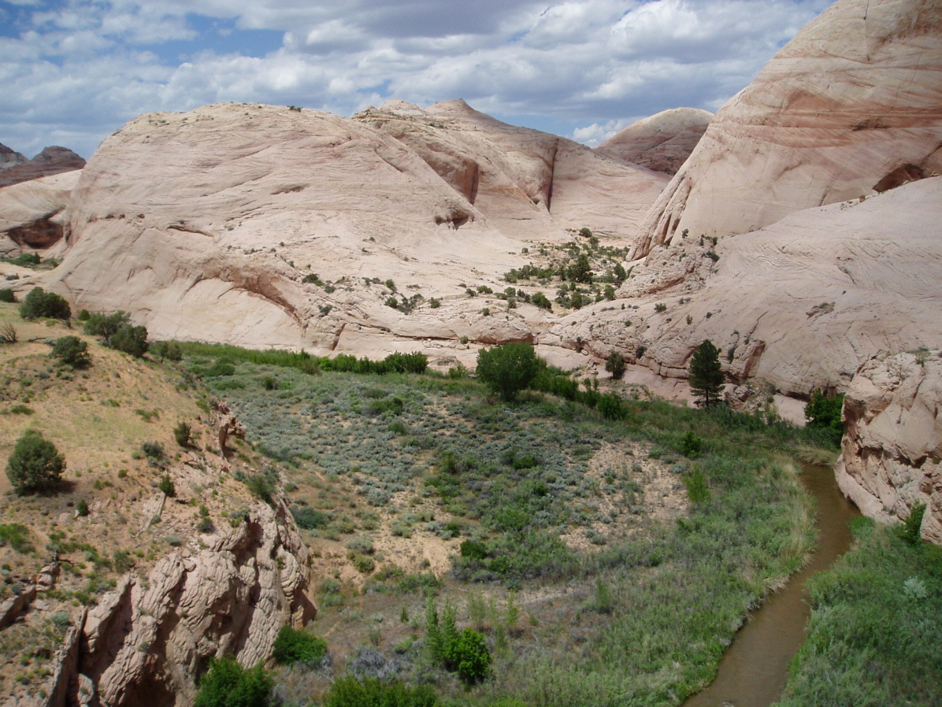
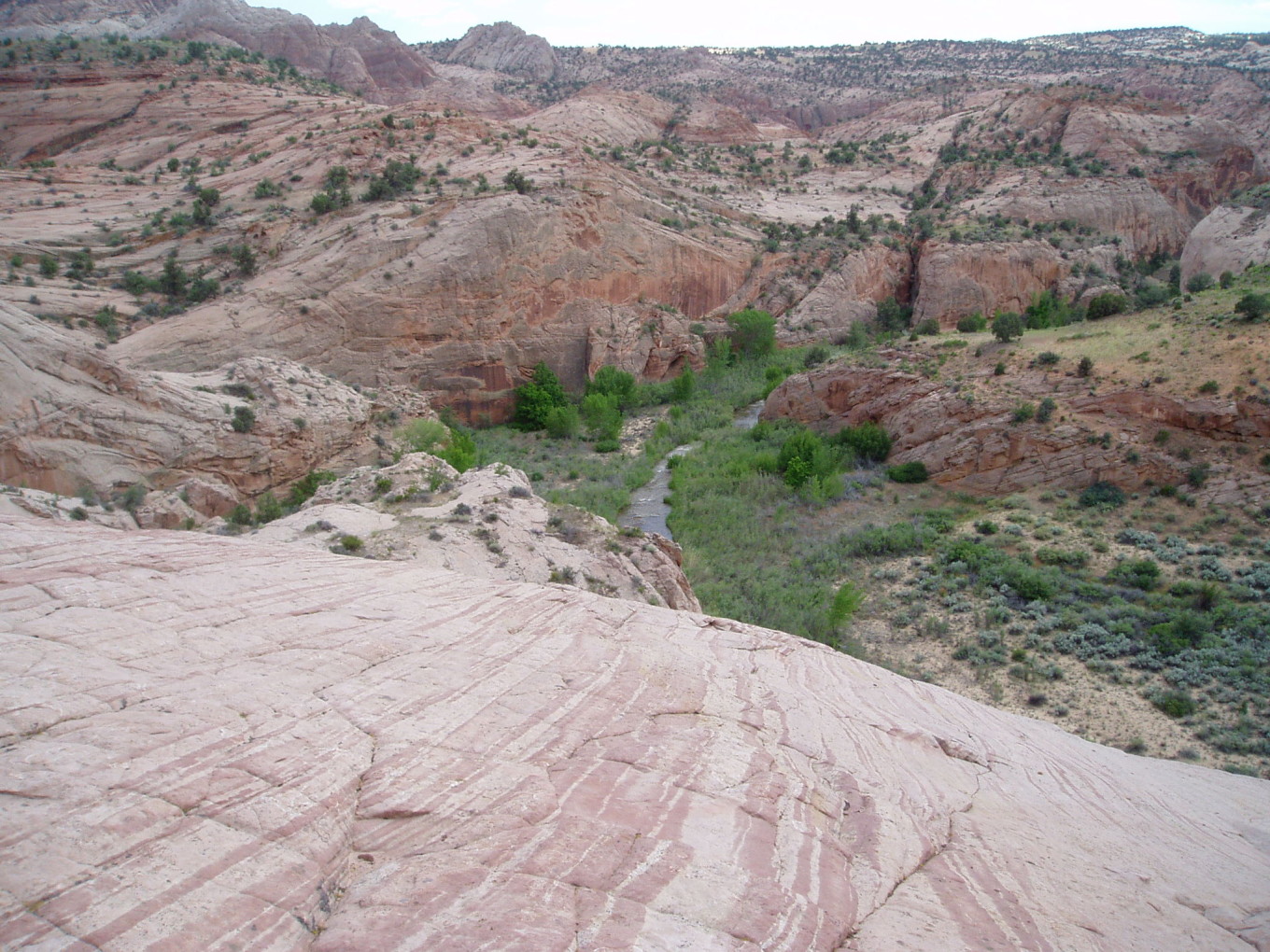
After lunch, we climbed back up to the cabin and then continued clockwise around the mesa. Looking at the map, I proclaimed our chances of completing the circumnavigation as “slim to none”. I climbed a small mound to see what I could see, but it wasn’t much. Eventually, we arrived at the top of an 80-foot cliff overlooking Boulder Creek.
![[photos/wcp/p5250152.jpg]](photos/wcp/p5250152.jpg.medium)
|
View from the top of the cliff. Our goal was to reach the hanging valley across the bend in the river. We eventually reached it by going over the mound partially visible in the right middleground.
Photo by Bill Priedhorsky. |
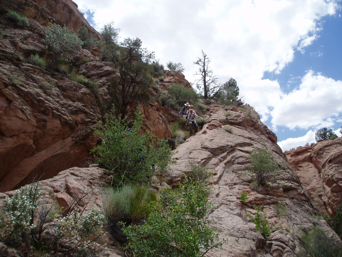
Deciding where to go next took extensive debate. Eventually, we settled on descending a ramp at our left to the creek, thrashing through the brush for a hundred yards or so, and then climbing up and over a mound into a hanging valley which the map indicated would lead to easy walking back to the pools.
![[photos/wcp/p5250153.jpg]](photos/wcp/p5250153.jpg.medium)
|
Descending the ramp. I had thought this route was hopeless, but it turned out to be quite easy as the way led into a crack filled with rubble that almost formed a stairway. The photographer is standing about two thirds of the way down, near the top of the crack part (which is not visible).
Photo by Bill Priedhorsky. |
![[photos/wcp/p5250158.jpg]](photos/wcp/p5250158.jpg.medium)
|
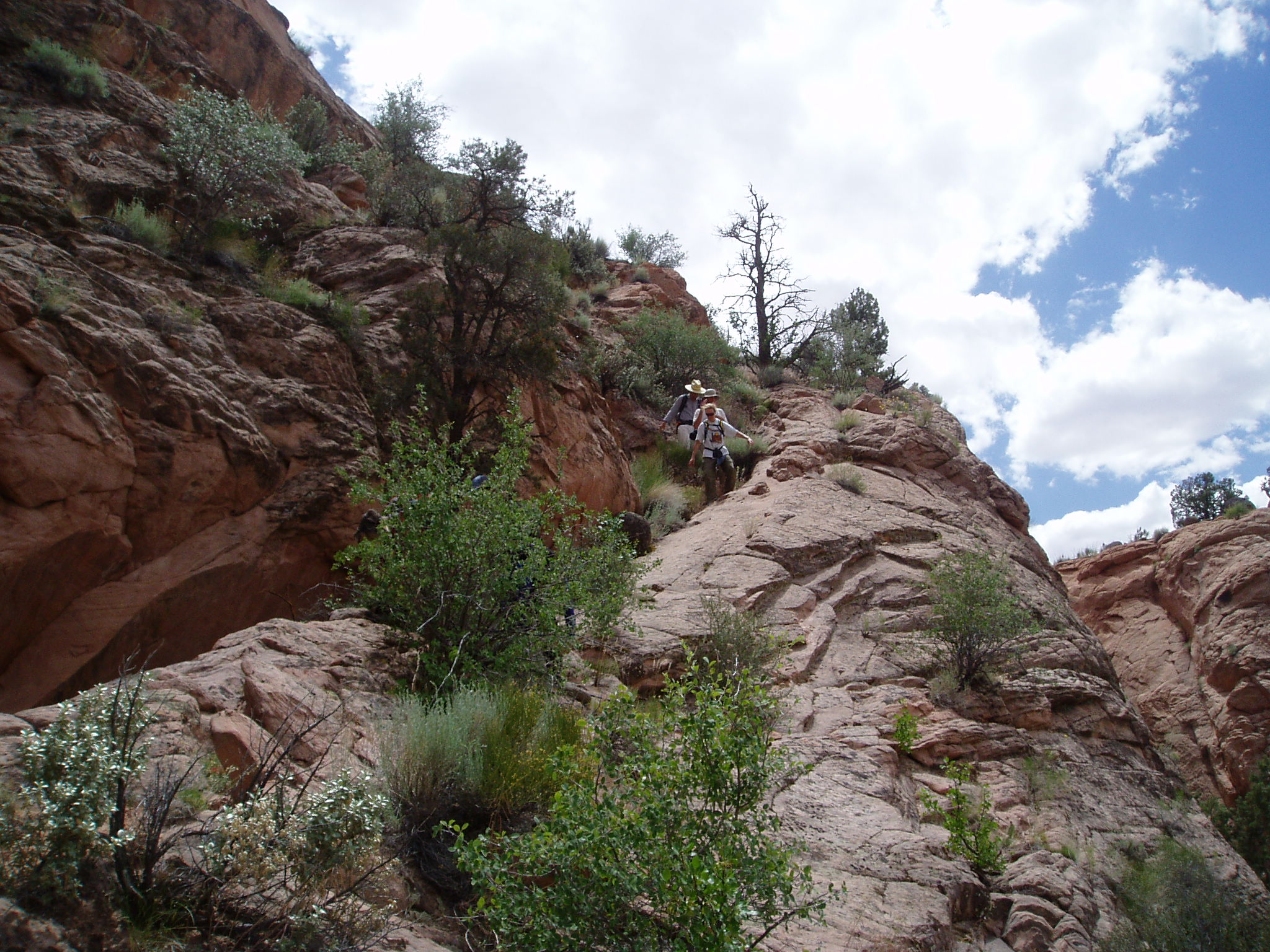
Looking south back at our route. We emerged into the frame on the left side, walked along the rim of the cliff with the trees at the bottom, and descended the first ramp to the left of the cleft. We then followed the base of the cliff and ascended to the present spot.
Photo by Bill Priedhorsky. |
![[photos/rrp/p6010239.jpg]](photos/rrp/p6010239.jpg.medium)
|
Hiking up the hanging valley. |
The top of the hanging valley took a little routefinding, but we were soon over the pass, and from there it was only a brief walk to the pool. We had barely stripped down and climbed in when Kathleen and the rest of the other group popped over the hill.
John and Charles’s dayhike
Our party included John, Dave, Caroline, Kim, Geoff, Kathleen, Karen, and me. The first objective was to hike to the Boulder Creek narrows so the Scudders and Geoff could “run the rapids” in the narrows. By “run”, they meant “jump in and bash their rear ends into rocks while soaking their clothing in freezing-cold water thus ensuring both a bruised and soggy exit”. As a river runner experienced in both intentional and unintentional swimming in fast-flowing water, I declined on the grounds that “it was a painful idea”.
![[photos/cby/escalante_cby_130.jpg]](photos/cby/escalante_cby_130.jpg.medium)
|
Dave, Geoff, Kim, and Caroline get ready to descend into the creek bottom. Kathleen attempts to shoot video with Geoff’s digital camcorder. John and Charles remain unconvinced of the fun-to-pain ratio described while continuing to enjoy dry underpants.
Photo by Charles Yeamans. |
![[photos/cby/escalante_cby_131.jpg]](photos/cby/escalante_cby_131.jpg.medium)
|
Dave and Geoff attempt to pick a route on creek right. Geoff bumps down. Dave later traverses and finds a less bumpy route on creek left.
Photo by Charles Yeamans. |
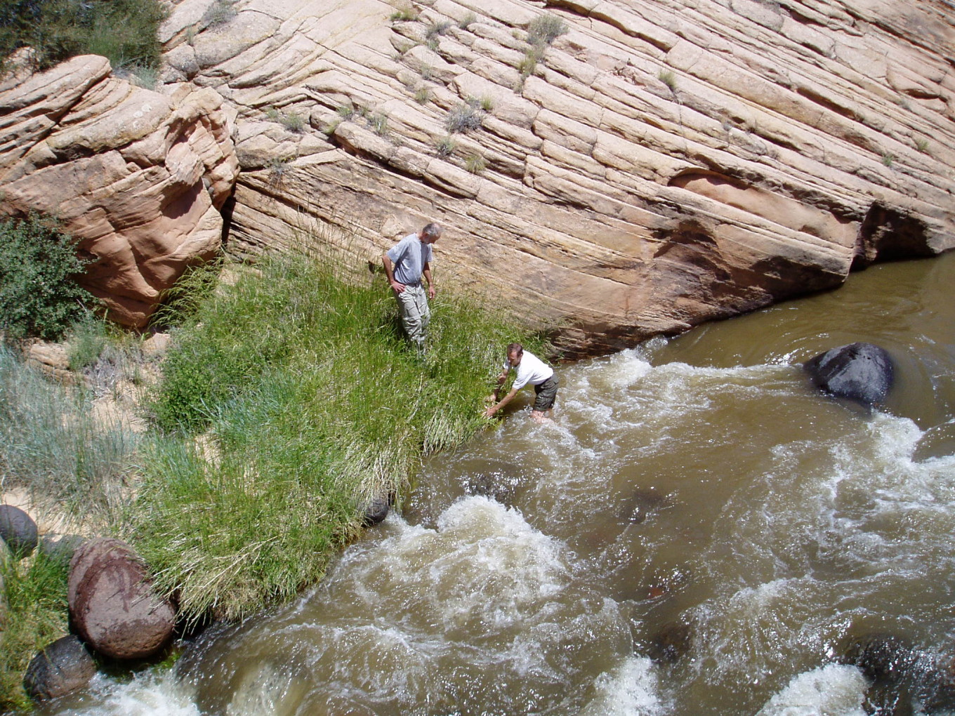
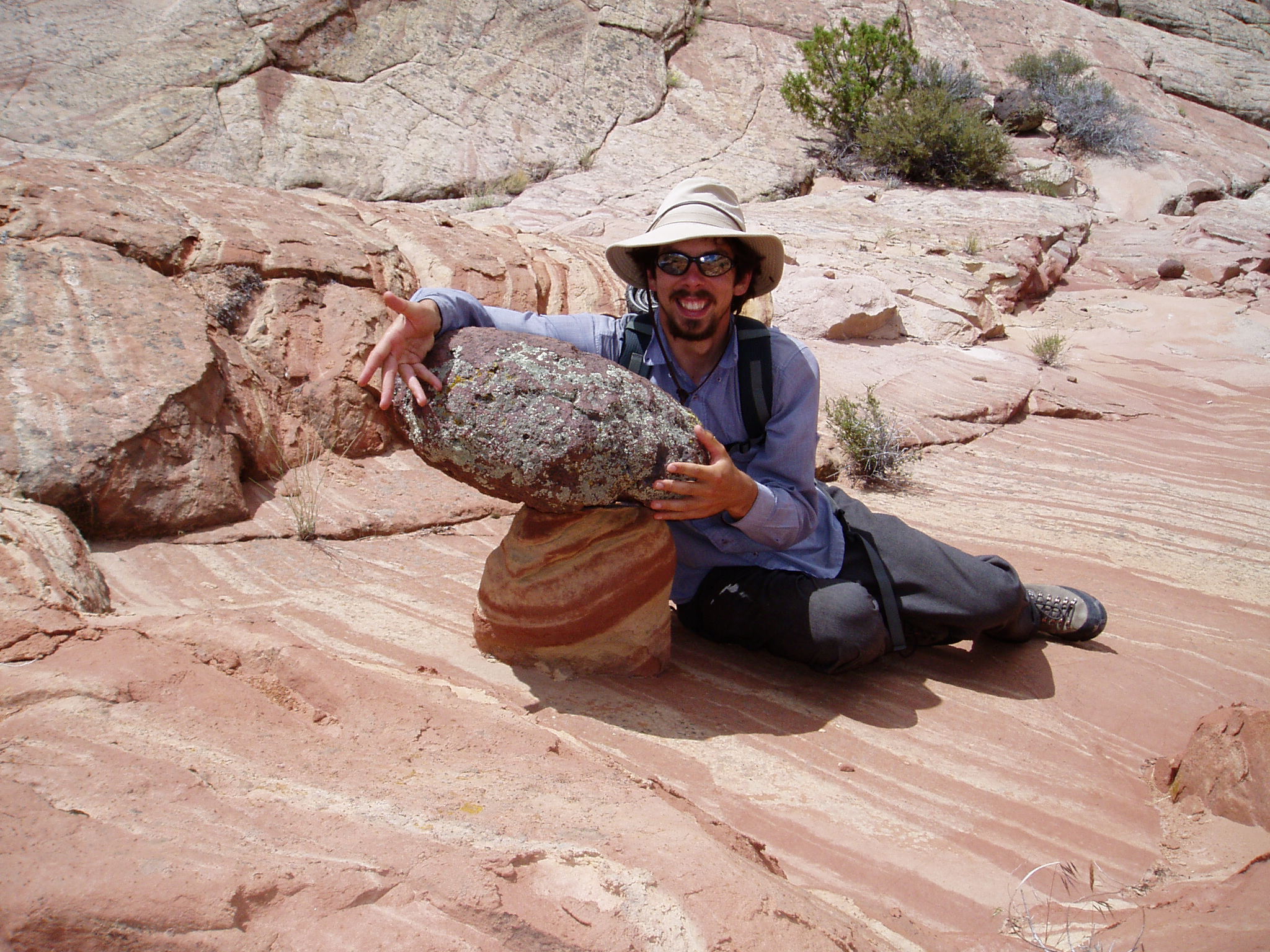
Geoff bumps down creek right. Dave, Kim, and Caroline bump left. All emerge cold but not too bruised. We ate lunch while Caroline regaled us with stories of what the Navy lets 22-year-old kids drive/shoot/fly. After lunch, we decided to find a collection of “mushroom rocks” Dave Scudder remembered from the 1996 Boy Scout trip. Ascending a small slickrock ridge, we found a number of good specimens. Igneous boulders provide a protective cap for the softer sandstone underneath. As the surrounding sandstone weathers away, the igneous boulder is left on a perch of sandstone.
![[photos/cby/escalante_cby_133.jpg]](photos/cby/escalante_cby_133.jpg.medium)
|
Wanna buy a mushroom rock? Cheap! Any credit OK!
Photo by Charles Yeamans. |
The mesa from the previous day’s hike rose to our east, and we decided that by ascending the slope and making our way toward some broken-looking cliffs near the top, we could summit the mesa, traverse it, and descend on my previous day’s ascent route down the northern point. No one had followed my route earlier, so it was left to my judgment as to whether or not that route could be descended on the other side. I thought it could. We had ropes and Dave Scudder. Of course we could.
The route to the top took us up a large slickrock slope that got increasingly steeper as we climbed. Halfway up, our group split. Dave, Caroline, and the two older women took a straight-up route that eliminated a semi-exposed slickrock traverse, but ended in a questionable climb through the cliffs at the top. Geoff, John, Kim, and I took a longer route with no climbing but a lot of exposed slickrock traversing.
Both parties made the top, about a half-mile apart, and met up at the narrowest part of the butte. We walked across the top amidst fields of hardy but fragile desert plants, stopping briefly at the high point. The route down was not straightforward. I found at least three distinct routes. With some jumping and belaying of the older women by Dave, everybody made it down.
![[photos/cby/escalante_cby_140.jpg]](photos/cby/escalante_cby_140.jpg.medium)
|
Kim leads the group down from the top of the butte.
Photo by Charles Yeamans. |
![[photos/cby/escalante_cby_141_enhanced.jpg]](photos/cby/escalante_cby_141_enhanced.jpg.medium)
|
Caroline prepares to make the 6' vertical jump necessary to avoid a belay down the other side of the point. It was either the jump, the belay, a difficult chimney, or a crawl under an overhang on an exposed ledge.
Photo by Charles Yeamans. |
From the base of the mesa, it was a short walk to the pools.
Together again
It was quite a pool party. At one point, we had 15 naked bodies in the water.
![[photos/rrp/p6010243.jpg]](photos/rrp/p6010243.jpg.medium)
|
Geoff Reeves jumping into the pool. |
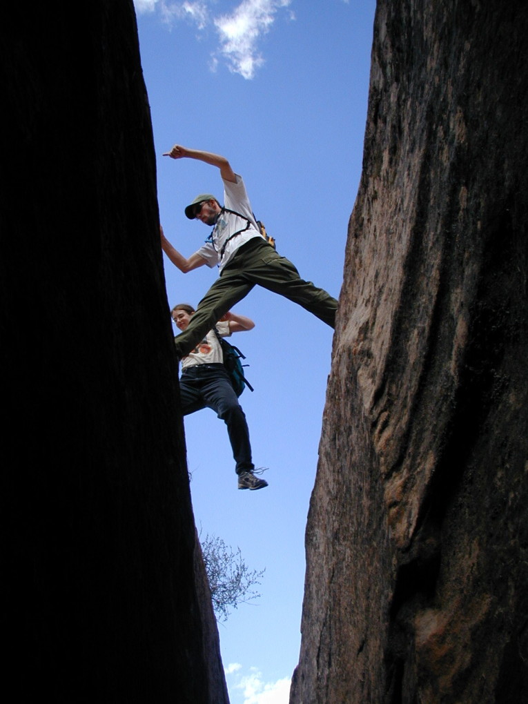
![[photos/rrp/p6010245.jpg]](photos/rrp/p6010245.jpg.medium)
|
Charles and Kim Scudder jumping the crack on the way back to camp. Note how Charles is helpfully pointing out the proper direction in which to jump, to avoid any confusion. |
![[photos/cby/escalante_cby_143.jpg]](photos/cby/escalante_cby_143.jpg.medium)
|
Me grinning like an idiot.
Photo by Charles Yeamans. |
![[photos/rrp/p6010246.jpg]](photos/rrp/p6010246.jpg.medium)
|
Charles descending the crack to where it opens up and rejoins the route home. |
John cooked lasanga-flavored Hamburger Helper for supper. Afterwards, Geoff Reeves ran into camp and declared, “We have a situation!”; then, after sufficient comic pause, “We brought too much ice cream — bring your spoons.” For some unknown reason, the other party had been unable to finish their Ben & Jerry’s ice cream. We were only too happy to help them in their time of dire need and quickly polished off the three extra pints.
Afterwards, we carried some chairs up onto the bench, out of the bugs, and read from Hayduke Lives for a while before stargazing.
Please continue reading on Day 17.