Escalante Adventure 2006 – Day 1
Synopsis: Hike from trailhead on Old Sheffield Road to “E-Cave” campsite on the Escalante River. Sunday, May 28.
![[p/img_0098.jpg]](p/img_0098.jpg.medium)
|
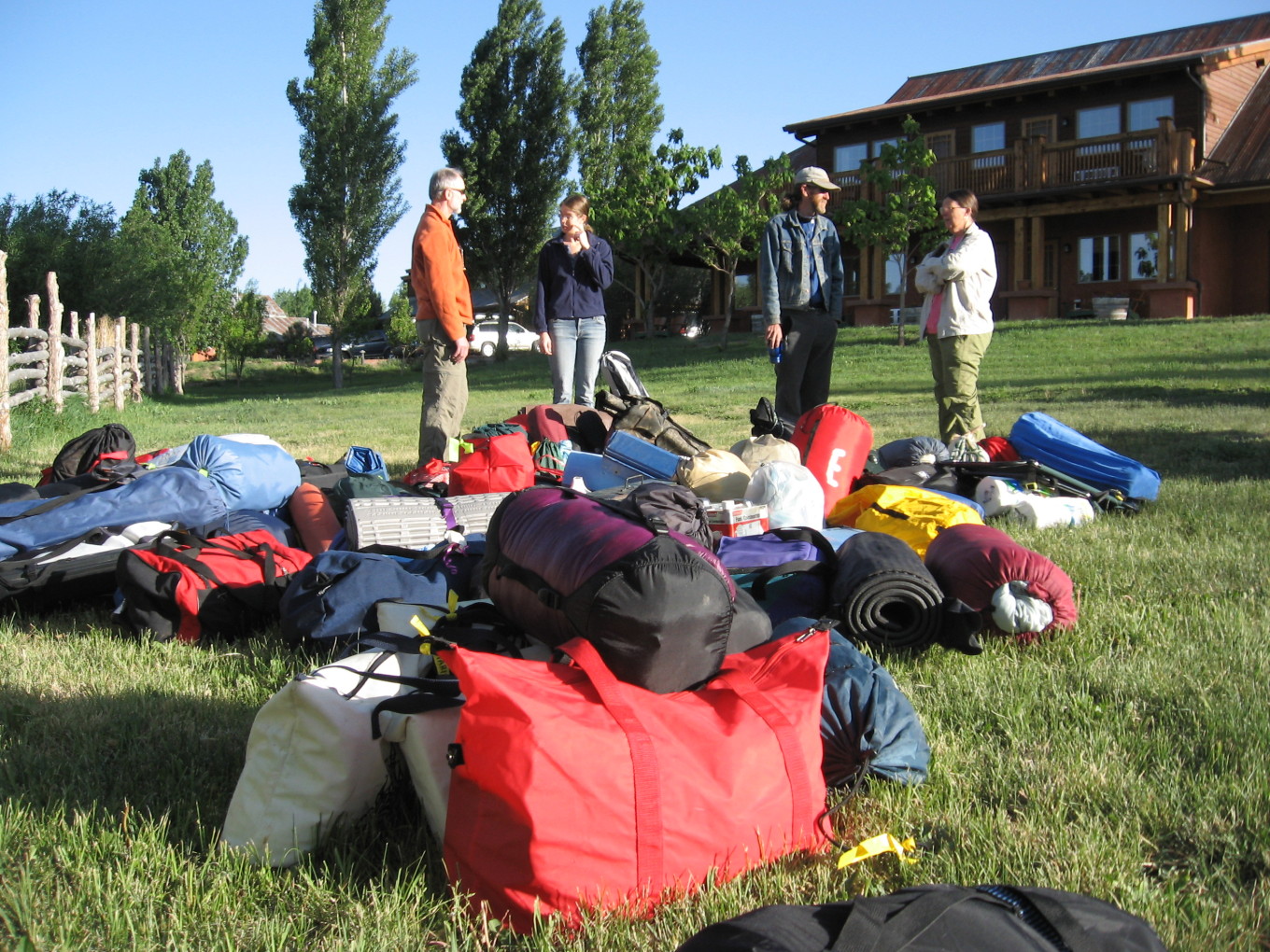
Task #1 for the first day was to finish all last-minute packing and lay out our gear for the llama people to pack up and prepare for loading onto the llamas. This pile began growing a few minutes before 7:30 AM and culminated in what you see here on the lawn at Boulder Mountain Lodge. |
Task #2 for the first day was “retire to the Hell’s Backbone Grill and eat a humongous breakfast”. We spent perhaps 90 minutes at breakfast. (Evaluating this evidence in relation to our level of overpacking is left as an exercise for the reader.)
We then climbed into our vehicles and drove to the trailhead. We had quite a caravan — Bevin leading the way in her Suburban pulling a llama trailer, yuppie SUVs of varying makes but all the same shade of tan, a Toyota Corolla in the same tan, and then me bringing up the rear in Charles’ red pickup truck. The views on the drive from Boulder down to the Escalante River along Highway 12 are spectacular, but I was busy keeping up and staying on the road. We turned off into the mysterious “private” dirt road and parked — time to load the llamas.
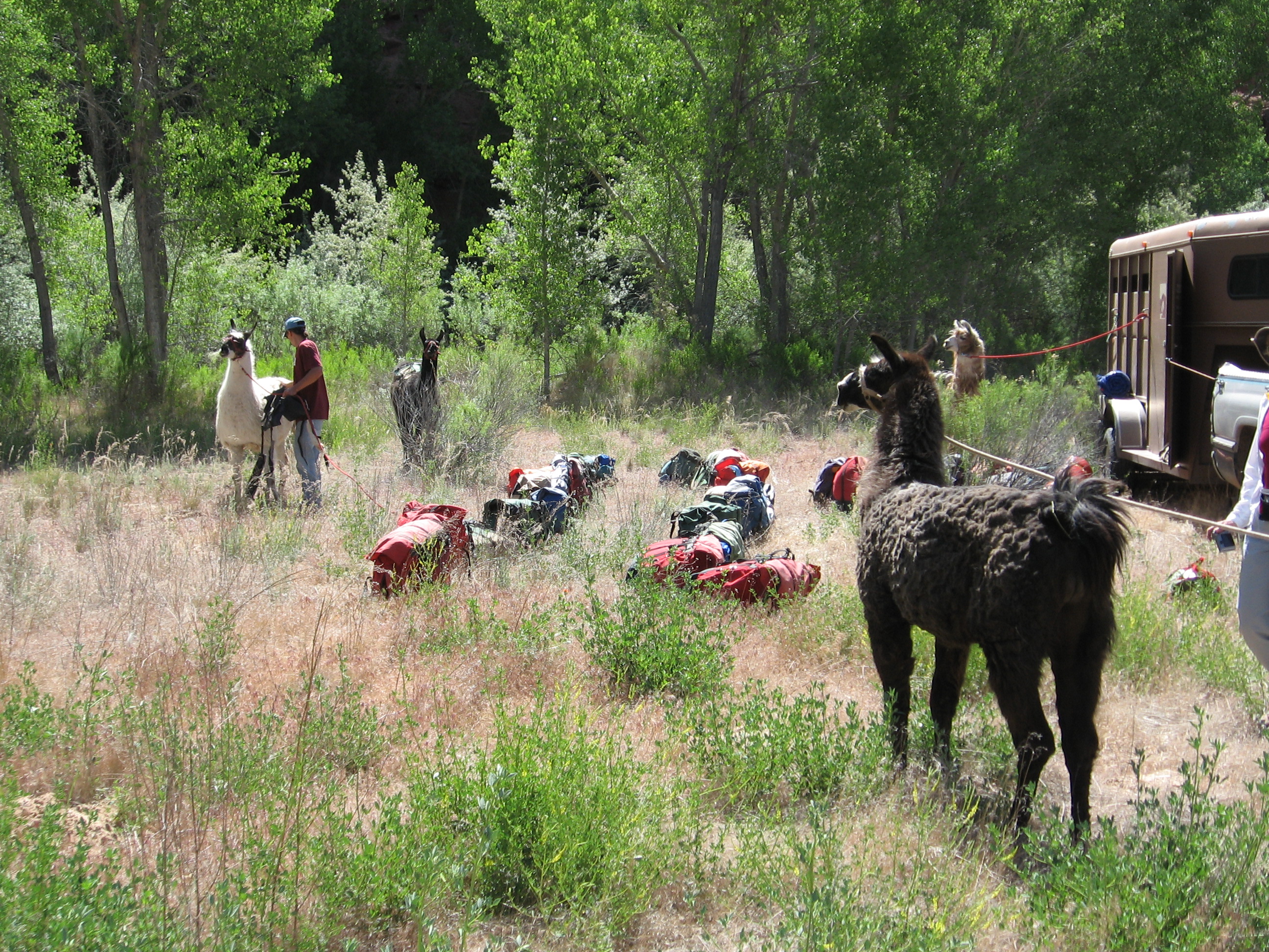
![[p/img_0105.jpg]](p/img_0105.jpg.medium)
|
“The Gauntlet”. Each llama would be led individually between the rows of panniers and loaded up. (Lest you surmise that this was an organized process — it wasn’t.) |
![[p/img_0108.jpg]](p/img_0108.jpg.medium)
|
BJ (blue hat) and Brian (tan hat) loading a llama; Kathleen is holding the lead. |
![[p/p5280050.jpg]](p/p5280050.jpg.medium)
|
Two llamas loaded and ready to go.
Photo by Bill Priedhorsky. |
After loading the llamas — a fairly lengthy process — we piled back into the cars. Two of us, Melissa and Kathleen, would help BJ and Brian (two of the llama people) lead the llamas along the river about four miles to camp. The rest of us would drive out the Old Sheffield Road and hike in via a different route.
First, though, we had to drop off a couple of cars at the river trailhead. I couldn’t figure out how to turn around on the narrow dirt road in Charles’ truck, so I drove the quarter mile or so out to the pavement in reverse. The parking lot was absolutely packed, but three Hell’s Angels were on their way out, so I took their spot.
Twenty more minutes of driving later, we were finally ready to get going.
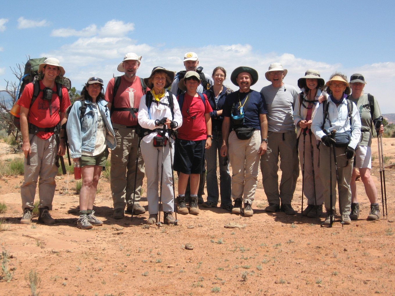
![[p/img_0117.jpg]](p/img_0117.jpg.medium)
|
Obligatory “before” photo. Left to right:
|
We struck out northeast towards the fabulous Escalante River canyons, following a pack trail. After a little winding through the sandy upland pinon/juniper forest, we topped a rise and scored our first great view, and lunch. We had gotten underway around 11:00 or 11:30 — not too bad considering we slept in until 6:45.
![[p/img_0125.jpg]](p/img_0125.jpg.medium)
|
Lunchtime!!! |
![[p/img_0122.jpg]](p/img_0122.jpg.medium)
|
Looking north from the lunch spot. The green skyline is the Aquarius Plateau. Much of our adventure last year took place within this view. |
We began to wind our way downward into the Escalante basin.
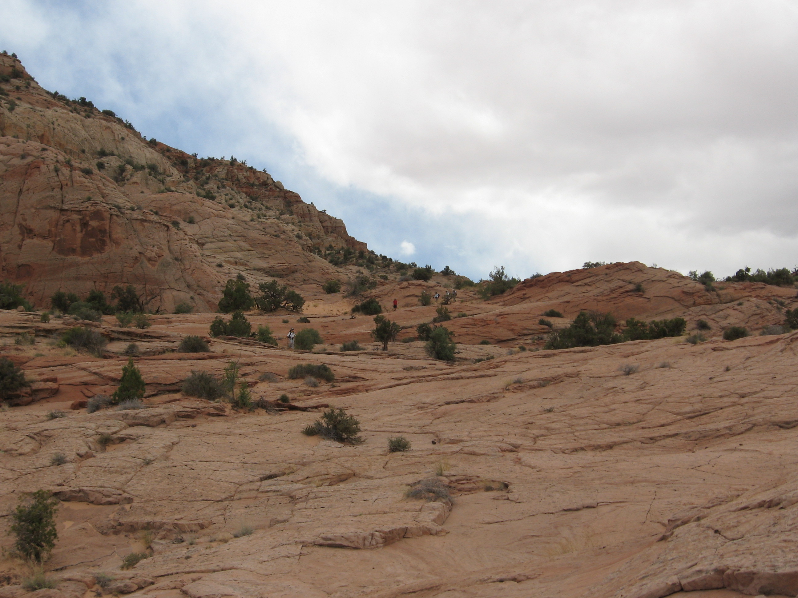
![[p/img_0127.jpg]](p/img_0127.jpg.medium)
|
Beginning the descent. Note the hikers in the center just below the skyline. |
![[p/img_0129.jpg]](p/img_0129.jpg.medium)
|
A little further down. |
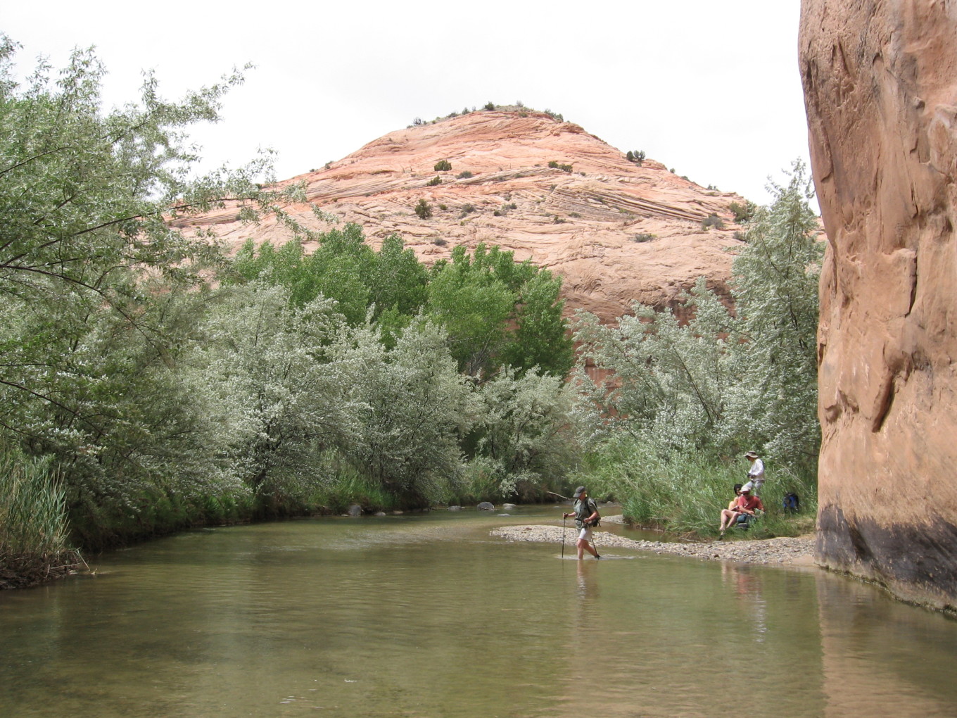
We crossed a bench covered in more sandy pinon-juniper forest, cryptogamic soil, and polished river rocks. The Escalante River once flowed at this height, and benches like this around here are littered with huge numbers of river rocks. At the edge, the inner canyon was revealed, and we descended to the river on the pack trail.
Bevin left us here, pointing us in the right direction. A hundred yards upstream was the first crossing of the Escalante River.
![[p/img_0131.jpg]](p/img_0131.jpg.medium)
|
Desert varnish, water, and trees at the first crossing. |
![[p/img_0134.jpg]](p/img_0134.jpg.medium)
|
Jackie taking the plunge. |
The water was lazy and very pleasant. It was running perhaps 25 cubic feet per second — quite a contrast from last year, where the river here was running around 500 cfs! Today, the crossing was knee-deep; then, it would have been chest-deep and grinding small boulders along the streambed.
![[p/escalante_cby_109.jpg]](p/escalante_cby_109.jpg.medium)
|
Escalante River, 364 days earlier. This was taken several miles upstream, above Boulder Creek and a few other tributaries, so the water down where we reached it this year would have been anywhere from 25-50% higher still. |
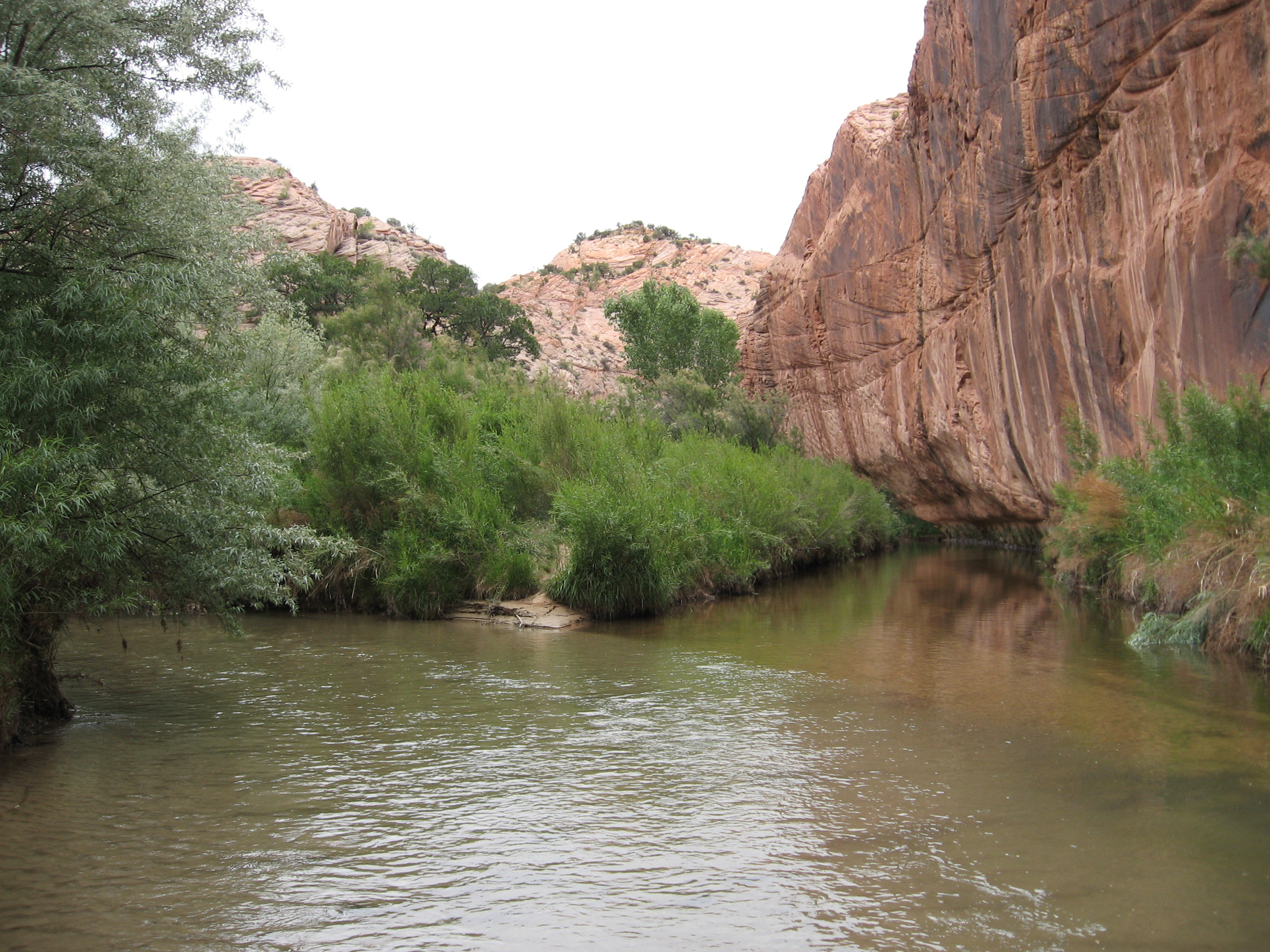
We strung out, small groups and singles making their way along the trail system which criss-crossed the river and disappeared and reappeared on a whim. I waded upstream for a few hundred yards when a trail into the river didn’t seem to have a mate on the other side. Slower going, but gorgeous.
![[p/img_0138.jpg]](p/img_0138.jpg.medium)
|
Boulder Creek entering the Escalante River (from the right). |
![[p/img_0139.jpg]](p/img_0139.jpg.medium)
|
Meadow below camp. The “E-Cave” alcove is visible in the center of the photo. |
Seven crossings later, I was the first to arrive in camp. Apparently the trip along the Escalante had been quite eventful. Melissa had been bowled over several times and stepped on once by enthusiastic llamas, the party had become separated and Brian the llama guy had taken Melissa on an unnecessary backtrack of some length, the panniers kept coming loose, and a few apparently had fallen into the river.
However, the real excitement was yet to come. Everyone trickled into camp, and after not too long everyone was present except Jan — expected, since he didn’t bring good river shoes and was removing and putting on his boots at every crossing. But he didn’t show, and he didn’t show, and soon it had been an hour. The entire hike from the trail down had taken perhaps 45 minutes for the rest of us, so the situation was worrisome. We call out periodically.
The best hypothesis we could come up with was that Jan was on the other side of the river as he passed camp and missed it — it’s invisible from over there, and there’s a well-trod trail. We sent out two search parties, one upstream and one downstream. After a half hour or so the radios crackled as they came back into range, and they emerged from the bushes, one, then the other. No Jan.
We fart around a little bit. It’s an interesting situation, as it’s not one that needs the attention of everyone. And Jan is experienced and very tough. So, most folks are bustling around with usual camp business and are apparently oblivious. We conclude that as no one would be silly enough to get turned around in a canyon with a stream clearly flowing downhill, and we started out going upstream, it’s much more likely that he passed camp without noticing. Dave and Dennis pack up for a more serious search. They’ll go upstream, one on each side of the river, and go all the way to the highway if they need to. I throw my survival kit and some water into my daypack and head up onto the rim above camp, hoping that from up higher I might be able to see something. I take a radio in order to be able to report back to camp.
It’s rough going. There is a steep trail climbing up a few yards from camp, and then I leave it and angle upstream, aiming for a high promontory that will let me see into the next big section of canyon. It’s steep, and before long I’m breathing very heavily. The views are fabulous. As I top a minor outcropping, the radio pops on with a weak signal: “fuzzfuzzfuzzJanfuzzfuzzdownstreamfuzzfuzzfuzz...”. I scramble up and key the radio: “Reid to Jan, can you hear me, over?” A pause, then, fuzzy but unmistakably, “This is Jan, I’m two miles downstream of camp and heading your way.” I ask if he’s OK, he says yes. I relay the news to Dave, who is just setting out: down in the canyon, he can’t hear Jan at all. I relay some messages between Jan and Dave, mostly reconfirming his location and that he’s moving towards camp and OK. The search is abandoned: now we wait.
I make my way back down towards camp, sitting for 15 minutes or so on the slickrock that forms the roof of our alcove. When I wander back into camp, I’m treated as a conquering hero. While in retrospect it’s clear that people were pretty worried and they wanted to express their relief, I don’t think I deserve any credit for finding Jan. I got lucky. I went higher to see, not with any intention of raising Jan on the radio.
Another half hour and Jan rolls into camp. Boy, are we glad to see him. Hugs all around, and someone presses a glass of wine into Jan’s hand. It’s around seven o’clock, three hours after the rest of us got to camp. Here’s Jan’s take on the matter:
When we got to the river, I took off my hiking boots and socks at every crossing and changed into a pair of sandals that I had recently purchased for the crossings. I talked to Bill before the trip about crossings, and he told me he expected very little in the way of stream crossings or water walk. Although I did look for a nice pair of water shoes, I couldn’t find any that I liked. I was looking for very light but sturdy sandals that fit well, and that were on sale. I didn’t find them, so I decided to wait until after the trip to get a pair, since I did find an inexpensive poorly built pair that would do for a few uses, but certainly not prolonged action.
After many crossings with my sandals, and having to repeatedly change shoes and socks, I found myself behind the rest of the group who had all given up on changing shoes and were now apparently wearing their water shoes continuously. My sandals weren’t up to continuous use. No one was worried about my having dropped behind at this time, probably because I was a strong and experienced hiker. However, some of my friends realize that I have literally gotten lost in my backyard several times. I have no particular issue if I have a map and compass, but I didn’t ask which map to bring for the trip. Besides, I much prefer to let Bill and Dave do the route finding since they are both better than I ...... it turns out that route finding ability is closely linked to good memory, which I simply don’t have.
I continued along happily with my slow but effective technique until I was close to camp. Apparently just before camp I got turned around somehow and started back the way I had come. The trail was a bit confusing and wound in and out of a jungle of bushes, trees, etc. In my very rushed plodding and trying to keep up I had failed to notice that we were walking up river all along, and that I had now begun walking down stream. Unfortunately, I knew next to nothing about our destination, and wasn’t concerned at the beginning of the trip because the group tradition has always been to make sure all parties were accounted for during a hike ...... for some reason, that didn’t happen this time. Since I assumed I would eventually come upon the rest of the crew, I kept walking until I ran out of trail. I had done well over 20 crossings by the time I was sure that I could not possibly be walking in the correct direction. I turned around and began to trace my steps back, and I gave up on protecting my brand new $350 leather hiking boots. All along I tried to contact the group via radio on the agreed upon frequency, but was well out of range.
When I got within radio range I was happy indeed to hear Reid on the radio ...... I realized that I had probably frightened the rest of the group by not showing up for quite some time, and was happy to finally make contact. I assumed Elizabeth, who knew me very well, would tell the others not to worry. As it turned out, she did tell them not to worry, that I get lost in my own backyard, and that I would eventually find them ...... they were still worried. I wasn’t! Sorry guys!
PS: I have since purchased a nice light pair of running shoes that I will use for water walking. This technique works very well for Dave, so it should be fine for me. I will still bring along my hiking boots.
He got within 1/4 mile of camp before he got turned around. Doh!!!! To Jan’s credit, I saw the spot where we think he started back downstream, and a well-worn path turns downstream while a much fainter offshoot continues up.
![[p/img_0145.jpg]](p/img_0145.jpg.medium)
|
Hanging out in camp. Jan (back to camera) has been rescued. |
Dinner was famous spaghetti courtesy of Elizabeth and Karen. Muy bueno.
Please continue reading on Day 2.