BWCAW Adventure 2006 — Pow Wow Trail
This trail is a 27-mile loop through the forests northwest of Isabella Lake. The trailhead is perhaps an hour southeast of Ely, Minnesota.
| Guidebook: | John Pukite, Hiking Minnesota, pp. 76-79. Falcon Publishing, 1998. 1st ed., 3rd printing. |
| Map: | McKenzie #18 and #19, 2000 eds. |
(Note that listing our guidebook above is not an endorsement. We encountered numerous problems with it, which are detailed below. Perhaps more recent additions have corrections — one can hope.)
A second note: This trail is remote, obscure, and sometimes extremely difficult to follow. You should be prepared and experienced before you try to hike it.
Day 3, September 1
We were on trail around 3:30. The trailhead is well-marked with a large sign, and we struck out from the parking lot following a bold, clear trail.
![[p/img_0661.jpg]](p/img_0661.jpg.medium)
|
Sign marking the beginning of the trail. |
![[p/img_0659.jpg]](p/img_0659.jpg.medium)
|
The parking lot, which serves both the trail and a popular canoe put-in, is at the site of the former logging town of Forest Center. This sign explains the situation. Note the first word in the third-to-last line. |
After a little while the trail began to be a little more overgrown, but it was still quite easy to follow. Reid was becoming more and more apprehensive, however, because we weren’t heading in the direction the map said we should. Eventually, the trail emerged onto an old logging road. This sparked a bit of an argument. Erin was in favor of turning right — which would send us north, the direction we wanted to be going in — while Reid struggled with his fading recollections of getting started on this trail six years ago with the Macalester Outing Club. The book goaded us with “the first mile leads up to Isabella bridge, which might make a nice, short stroll for someone coming back from a canoe trip”, i.e. no problem at all, you idiots. Eventually, with Reid in a deepening funk, we headed all the way back to the parking lot and then beyond, down the canoe portage to Isabella Lake.
No possibilities emerged, and after further map consultations, we decided that it must be out of date — always risky thinking — and there seemed to be no choice but to walk all the way back to the T. When we finally got there and turned north, it was only a few hundred yards until we encountered a sign welcoming us to the BWCAW, which (oddly) was on the map. Apparently, we had been on the right track all along. (Reid wishes, in retrospect, that he had listened to Erin the first time. Even though her assessment of our location turned out to be wrong, her opinion on what to do was right.)
Reid looked at the newer (2005) version of the map later. The start of the trail is shown correctly on it, but other stuff is missing. There are several campsites not shown on the new map, and the new map omits GPS coordinates of campsites and a number of landmarks which are shown on the old one. We didn’t however, verify the accuracy of these. The old map also has quite a view “vistas” which don’t seem to exist.
There were ATV tracks cutting around the wilderness sign and continuing down the old road. This was frustrating to Reid, and he made a mental note to complain later at the ranger station after we hiked out.
With frustration ebbing, we charged northwards. At the Isabella bridge, there was a family of canoeists camping. The kids were playing in the water, the husband was dragging a massive downed tree out of the woods, and the mother was very excited to see us, yelling, “Look — backpackers!”. She and the husband wanted to know about the condition of the trail, and they seemed a little disappointed upon learning that we were only a mile or so from the parking lot.
After the trail split for the Pow Wow loop, we were starting to look forward to making camp, but we still had about two miles to go until the first campsite at Marathon Lake. We knew we might have our work cut out for us, as Reid recalled having trouble finding the campsite when he was on this trail with the Outing Club. The terrain wasn’t terribly exciting, being mostly a hike through thick woods, which is why we hiked in the direction we did (clockwise) — save the best stuff for last.
![[p/img_0662_joined.jpg]](p/img_0662_joined.jpg.medium)
|
|
The trail forks. We head left (clockwise); two days later we will emerge from the right. |
Nearing Marathon Lake (or when we thought we were nearing, precise location being very difficult to figure in the dense woods), we had our eyes peeled. There were a few spots that seemed possible, though they looked more like deer trails than spurs. We kept going until we saw a well-established fire pit a few yards off the trail. There was no official fire grate, but there were a couple of reasonable tent pads, and the site had clearly received significant use. This was where Reid had camped before, but we explored ahead and back a little ways to see if a more legitimate site appeared.
Erin was about to fall over at this point (remember that we had hiked an extra mile and a half at the beginning due to being lost), and we only explored a few minutes before deciding that what we’d found would be fine. We never did find a latrine, and with no fire grate, we wonder if we did indeed find the official site, or if there is no official site. On the new map, there is still a campsite marked here.
Reid went off to find water while Erin started setting up camp. Water access at the trail was very poor — swampy and stagnant — and while he walked all the way around our little peninsula back to the trail (scaring Erin when he emerged back in camp from a strange direction), nothing better presented itself. So, we made do with algae-filled water.
The book describes this site as “a high and dry campsite on an exposed bedrock, a short distance from the lake”. This was indeed true, but that text implies to us something much nicer than a small clear area in the middle of the woods. We wonder if the author is also a realtor — cozy rather than tiny, quaint for old, etc.
We had some box curry for supper, which was only so-so, even after a long day. Reid wasn’t too happy with the bear rope setup, even though he got the rope up in one try, but we were too tired to care much.
Day 4, September 2
![[p/img_0666.jpg]](p/img_0666.jpg.medium)
|
Our campsite at Marathon Lake as we were leaving. |
We broke camp around 10:15. A lot of the trail this morning was freshly cleared, and there were still ATV tracks, even this far in. Maggie (the ranger) had told us that just a few weeks before on the Pow Wow a guy had gone missing (they found him after a week), and Reid began to surmise that the ATV tracks were part of the search and rescue — not bozos illegally driving in the wilderness.
![[p/img_0015.jpg]](p/img_0015.jpg.medium)
|
A bee slurping flowers at our first break. |
![[p/img_0018.jpg]](p/img_0018.jpg.medium)
|
Reid checking the map. |
Pretty soon we came to the Campfire Lake campsite. This site is not on the lake, though it is in a much more open area. Water access is so-so, though better than Marathon Lake, along a trail leading north from the fire grate. The latrine is across the trail from the site, through some high grass and a little into the woods. The way is marked with hard-to-see cairns and pink flagging.
Not long after was a fork in the trail. Both directions seemed equally well traveled. The left (south) fork leads to Quadga Lake and perhaps some campsites, though we didn’t investigate.
The trail was pretty easy to follow all the way to the Superstition Lake campsite. The book mentions a “deep ravine below Diana Lake”, but we didn’t see anything resembling a ravine, let alone a deep one. The Superstition Lake site — a little way down a spur trail — is on the lake, though its view is obscured somewhat by trees. It’s small and certainly workable, though we wouldn’t classify it as “splendid”, as the book does. We stopped here for lunch, where Reid discovered that he still didn’t like bleu cheese.
![[p/img_0669.jpg]](p/img_0669.jpg.medium)
|
Erin tying her shoe. For some reason, this was a frequent occurrence. |
After Superstition, the trail became much rougher and very brushy. The guidebook describes this section as a “friendly, moss-covered trail”, and we found it to be so. It reminded Erin of the British Isles — there was dark green moss, light green moss, and lots of colors in between. Erin was walking behind Reid, and she could often see his footprints in the moss, it was so soft and thick.
Beginning at Superstition and through the rest of the day, the trail was difficult to follow and nearly invisible in places, though we fortunately managed to not get lost. There wasn’t much deadfall, but the trail was frequently choked with thick brush, sometimes neck-high.
At Mirror Lake, the campsite is literally a wide spot in the trail. The book’s “a bit above the water” turns out to be the top of a large rock and brush cliff with no apparent way down to the water. We couldn’t see the round boulder the book says is visible until well after the campsite. There are again several trees obscuring the lake view, though Mirror Lake is remarkably scenic.
![[p/img_0671_joined.jpg]](p/img_0671_joined.jpg.medium)
|
|
Mirror Lake. I stepped in water over my ankle and nearly fell into the lake while taking this panorama, so you better appreciate it. |
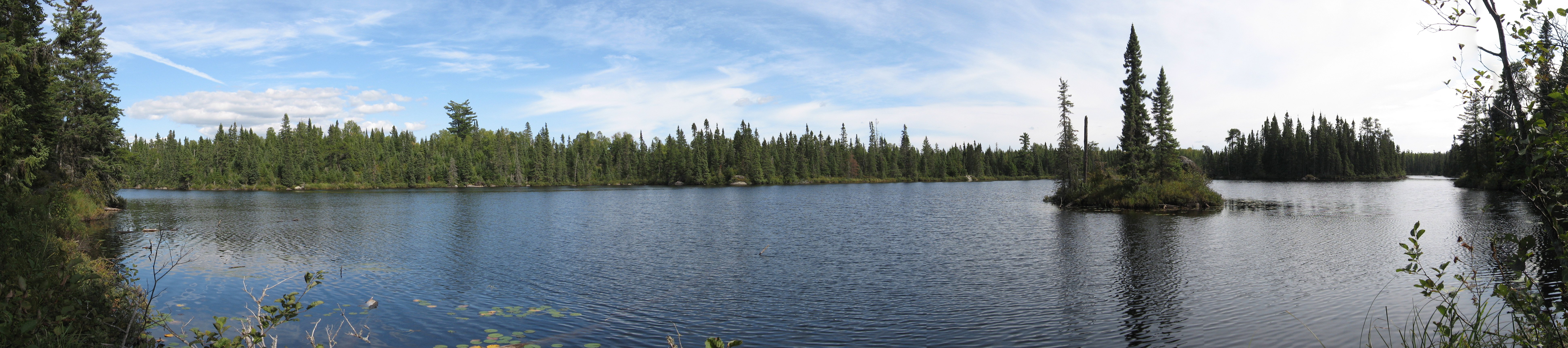
The one place we wondered about where to go was along Path Lake. We encountered a wide, freshly and aggressively cleared trail leading up away from the lake into the woods. Reid went up it a hundred yards or so, but it was clearly not going in the right direction. We wondered if it had to do with the search and rescue (though we learned later that that took place on the opposite side of the loop) or perhaps fire-fighting operations that had been going on recently.
It was hard to decide where we were going to stay for the night. Reid thought Path Lake had a nice campsite, and about a mile past that was Rock of Ages Lake, which also had a site. After Rock of Ages, there was nothing for about five miles. We planned for Path, with Reid gushing descriptions of huge boulders overlooking the lake, a tent pad that wasn’t in the middle of the path, and general spectacular beauty.
![[p/img_0678.jpg]](p/img_0678.jpg.medium)
|
Beaver dam near Mirror Lake. |
When we got to Path Lake, the site was certainly much nicer than anything we’d seen so far, but nothing meeting Reid’s increasingly sensational descriptions. Erin was getting tired, but Reid was pretty sure the site he was thinking of must be Rock of Ages, so after a break we went on, knowing that Rock of Ages was the only option and hoping that it was nicer than the site at Path Lake that we were leaving behind. (Note that if you stay here on the first day of a holiday weekend, you might have to compete for Path Lake or deal with company in this tiny site, as it’s the first nice site in this direction of the loop and a reasonable full day’s hike from the trailhead.)
As we approached the probable location of the campsite, we heard voices. Our hearts dropped at the thought of turning around and heading back to Path Lake. As we turned a corner and climbed into the open, we discovered that (a) the voices were a dad and his two kids fishing, (b) this was the campsite, (c) Reid’s descriptions had hardly done it justice, and (d) the family wasn’t — to our massive relief — camped there. The family was canoeing on Horseshoe Lake and had done a short afternoon hike down to this spot. Later, Reid showed them where the latrine was, i.e. two ravines down a very faint trail and over several deadfall, and they were very impressed. (The latrines at these hiking campsites can be extremely difficult to find, a sharp contrast to the canoe-camping sites.) They said that there were a lot of people on the larger lakes now that it was th holiday weekend.
We set up camp. In this instance, the book’s description is surprisingly nondescript — “the camp sits high, overlooking the lake in a canyon-like setting with views of its islands” — but this is among the finest campsites Reid has ever camped in, though it’s a little short on good tent pads. (If you stay here, please treat it gently.) The boulder Reid had talked about overhung the lake a little — the last time he stayed there, they collected water by lower a coffeepot on a rope down from the rock and scooping it up. Erin climbed down to the water and took a swim/bath.
![[p/img_0686_joined.jpg]](p/img_0686_joined.jpg.medium)
|
|
Rock of Ages Lake. |
![[p/img_0701.jpg]](p/img_0701.jpg.medium)
|
Rock of Ages Lake. |
Reid cooked enchiladas for dinner and even met Erin’s challenge of not overflowing the pan. In fact, we were able to eat all of what he made and not feel like our stomachs would burst, which is unusual on enchilada night!
Day 5, September 3
![[p/img_0705_joined.jpg]](p/img_0705_joined.jpg.medium)
|
|
Rock of Ages Lake the following morning. |
![[p/img_0712.jpg]](p/img_0712.jpg.medium)
|
Rock of Ages Lake. |
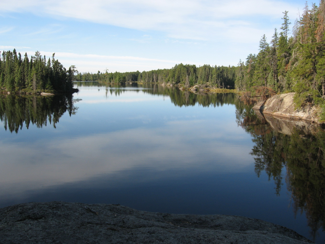
As we were eating breakfast, Erin heard someone coming up the trail. He didn’t hear us, and his eyes bugged out a little at coming around the corner and discovering people! His name was Scott, and he seemed like a nice guy. He was out solo. We talked about our plans for the day, and it turned out that we were both hoping to stay at Pose Lake, the last site on the loop (about 4 miles from the trailhead). He offered to share, and we said sure. Reid was a little leery of the idea, since he had never shared a campsite with another party, but it seemed like there were no other options.
![[p/img_0715.jpg]](p/img_0715.jpg.medium)
|
Erin having breakfast in camp. |
Scott moved on, and we packed up and hit the trail around 10:30. As we left camp, we could hear additional voices approaching, but we lost them after a little while.
After Rock of Ages, the trail was much nicer, and it appeard to be freshly cleared, probably with a chain saw (which is not normally allowed in the BWCAW, even for trail clearing).
In the area between Lake Three and Horseshoe Lake, the trail becomes very confusing in a complex mishmash of trail and portages. We didn’t notice any of the blazes alluded to by the book. Somewhere in here it seems there is access to a campsite on Lake Three, though this is also a canoe campsite on one of the most popular lakes in the BWCAW.
![[p/img_0720.jpg]](p/img_0720.jpg.medium)
|
On the trail. |
After leaving this area, we took a break at a huge, round boulder marking a trail down to a campsite on Horseshoe Lake (again, one that has easy canoe access). The book describes this area as the turnoff for the North Wilder campsite, but that’s incorrect.
Around lunch time, we came around a corner, and Reid saw Scott disappearing into the woods, off the trail to our left. We turned right, continuing along the trail, to discover a huge pile of blow-down. It was kind of tricky to find the right way, but we picked our way around it and went another 15 minutes or so before lunch. As we were sitting at lunch, Scott padded out of the woods along the trail. We chatted for a few minutes; he was surprised to find us ahead of him. It turned out that he’d been lost when we saw him earlier, but he’d found his way out OK. He said that he was checking his map every few minutes, and that he sometimes had trouble finding the trail, but he was very cheerful regardless.
After lunch, we soon passed Scott again, and he said something about “the Czech couple”. Apparently, there was another couple on the trail — they had camped between Scott and us the night before, and he passed their camp at Path Lake before ours. He said that they were hoping to stay at Pose Lake, too, although Scott thought they weren’t very excited about sharing. Most of the sites we’d seen had enough clear room for three tents, but only if you didn’t mind sleeping somewhere that was very rocky and unlevel.
Scott said again how much trouble he was having knowing where he was, and we offered to walk with him, but he was happy to continue on alone. (Every time we bumped into him, Erin was fonder of him and the prospect of camping with him.)
At South Wilder Lake, we found the other campsite where Reid had stayed with the Outing Club. It was another wide spot in the trail, not too great. There was also a campsite marked on the map at North Wilder Lake, but we didn’t see it. Scott told us that he had seen it, and it was right off the trail. (Note that none of the campsites between Rock of Ages and Pose are marked on the book’s map.)
A short distance later, we walked out on a huge pile of boulders to the lake’s edge to pump water. There was an island so close to the short that it looked like you could practically jump to it — from a distance, Erin thought it was a peninsula. Reid was beginning to feel pretty tired, and thought we were nearly to the end of South Wilder. Unfortunately, he was disappointed to discover that we were only about 1/4 of the way.
Not long after this, the Czech couple came up behind us — they were moving fast, with walking poles. The Czech man didn’t have a shirt on and had a long scrape on his side. Erin couldn’t imagine plowing through brush like what we had to go through without clothing protecting her. The Czech woman looked very very weary, and they both looked just a little unpleasant. We’re not sure if they were really grouchy, or if it was a cultural difference, but they did not look like the kind of people with whom we were very excited about sharing a campsite. Erin put on her best happy face and said, “Oh, so it looks like we’ll all be sharing a campsite tonight, huh?” They made some unhappy noises and said they guessed so, and then they took off like the wind.
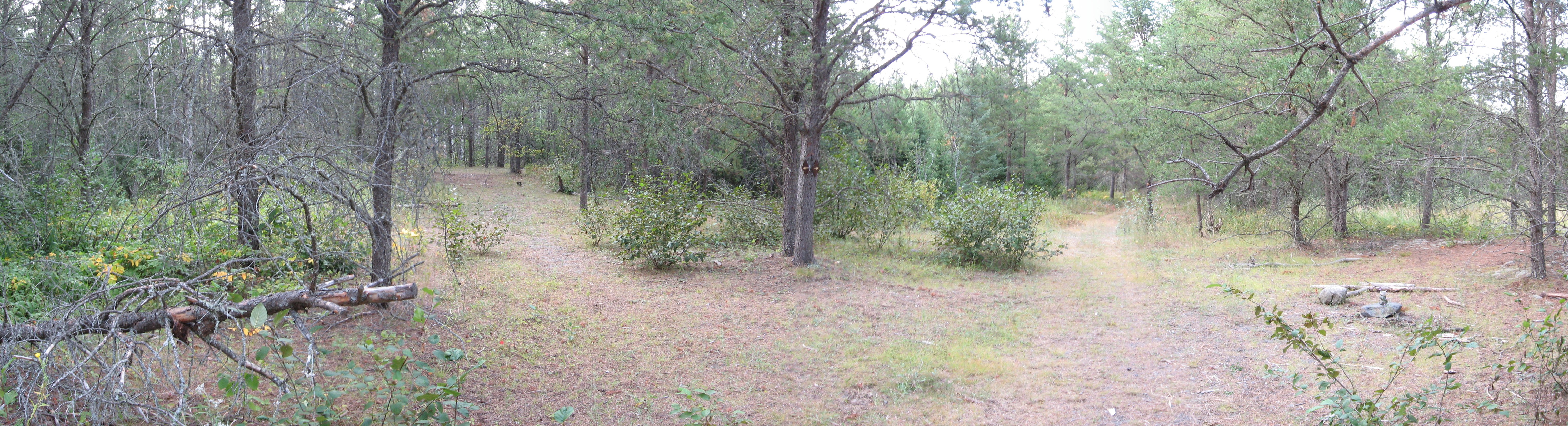
![[p/forest2.jpg]](p/forest2.jpg)
|
|
Reid checking the map. Can you find the trail in this photo?
Photo by Erin Tatge. |
There was a lot of blowdown between South Wilder and Pose Lake. Reid was getting very, very tired as we approached the campsite. The guidebook and map told us that it was on a spur trail, and we were keeping an eye out for it, as the area was pretty overgrown. Reid spotted it; there were two cairns, but both were being consumed by the undergrowth. A long marshy spur trail took us to the campsite. (The book shows two sites here, but we found only one.)
When we arrived, the Czech couple was nowhere to be found. We were a little bit worried about her — she looked exhausted when we’d seen here a few hours before. We can only hope that he didn’t make her hike the four more miles all the way out. Reid thought that the man’s job was to take the woman out to the woods and drag her around doing things she didn’t want to do. Erin wasn’t so sure.
After a little futzing, Reid went off to find a bear tree and make the cairns more obvious for Scott.
It was 5:30, and Erin decided that at 7:00, she was allowed to start worrying about Scott. We went down to the water’s edge and took another swim/bath, then dried out and started some boxed risotto for supper. At 7:10, as the risotto was finishing up, we heard a large critter coming down the trail, and Scott came around the corner! We all sat down to supper together — Scott had been eating ravioli out of cans (and had forgotten silverware, so he was eating with his pocket knife’s screwdriver!), and the risotto seemed quite a pleasant surprise to greet him at the end of a long, hard day on the trail.
Reid was very impressed by Scott’s perserverance and good cheer despite getting lost twice that day. It turned out that he had taken a wrong turn not too far before the lake, and that when we had been swimming, he was all the way across the lake and had spotted us! He wasn’t sure if we were trying to wave at him, or what. We had no idea.
(Incidentally, the Pose Lake site is quite nice. It’s got a decent view, fine water access, and two nice tent pads that have a little privacy. It’s a bottleneck, though, for the night before the last day of a holiday weekend.)
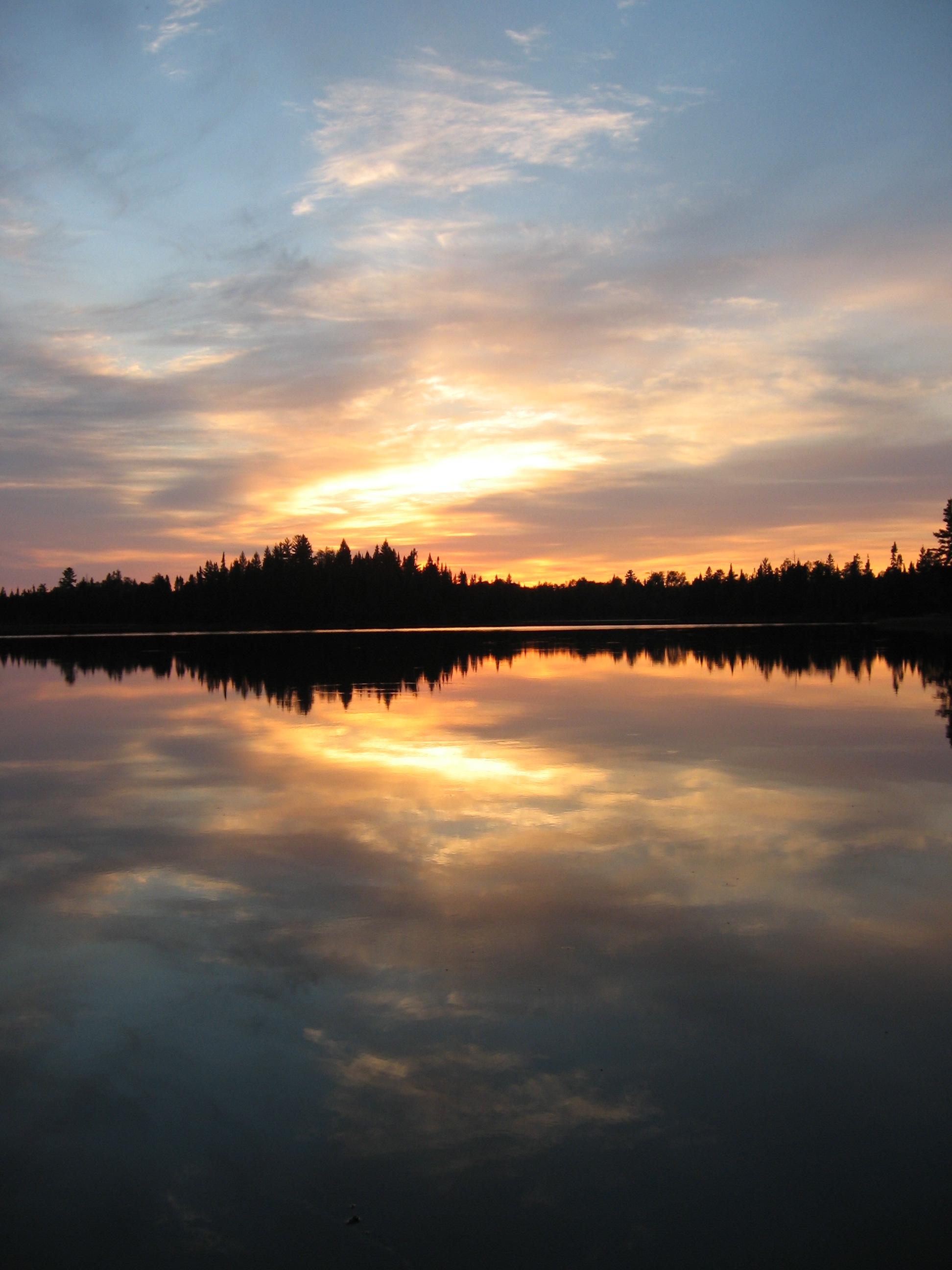
The sunset was glorious — bright oranges and pinks, and just enough clouds to have something really nice to reflect the light. The water was so still we could hardly tell which way was up. Quite a nice end to a long day’s hike.
![[p/img_0722.jpg]](p/img_0722.jpg.medium)
|
Sunset over Pose Lake.
Photo by Erin
Tatge. |
![[p/img_0742_joined.jpg]](p/img_0742_joined.jpg.medium)
|
|
Sunset over Pose Lake. |
We all sat at the fire for a while, chatting. Scott turned out to be a stand-up fellow, and we were pleased to share a campsite with him. Then, bed.
Day 6, September 4
Scott was getting ready to leave as we were getting up, so we said our goodbyes. We left not too long afterwards. On the way out, we saw a spot where a search and rescue ATV had tried to go between two rocks, unsuccessfully — there was a piece of reflector on the ground and scrapes on the rocks, with ATV tracks around the side of the rocks as a detour as well.
We passed the spot where Scott had told us the lost hiker went astray, which was also the same or very near to where the hiker in Lost in the Wild got lost — coming at it from the north, there was no question where the trail led. Coming from the south it would have been a tiny bit less clear, but it was still hard for us to imagine that anyone paying attention at all would have been confused. (Lost is a great book, but perhaps best read after hiking this trail.)
There were a few flat spots where one could camp scattered along the trail, but none had very good water access. Perhaps the Czechs stayed at one of these.
We got back to the car and changed (Reid scared some canoeists), then hiked down the portage to Lake Isabella for lunch, where a canoeist showed us how to hold a fish towards the camera in order to make it look bigger. Then, home.
![[p/img_0771.jpg]](p/img_0771.jpg.medium)
|
Erin and Reid after another successful trip. |
That’s all folks! I hope you enjoyed our trip report. (Return to the Main Index if you like.)