The Gulch 2010 – Day 5
Synopsis: Dayhike to Escalante River. Short-trippers hike out. September 14, 2010.
This day was a little bittersweet, as Sara, Kurt, and Kelly would be leaving us to hike out. That said, I was glad that we were able to work out the dual-length trip as I much preferred that to not having them at all.
Kelly adds: I wasn’t ready to leave. I would have liked to have stayed for the long trip.
![[rp/20100914-02324.jpg]](rp/20100914-02324.jpg.medium)
|
Group photo taken before we sent the short-trippers on their way (*sigh*). Left to right: Pete, Reid, Ben (note absence of ridiculous hat), Erin, Russ, Kelly, Kurt, Sara. |
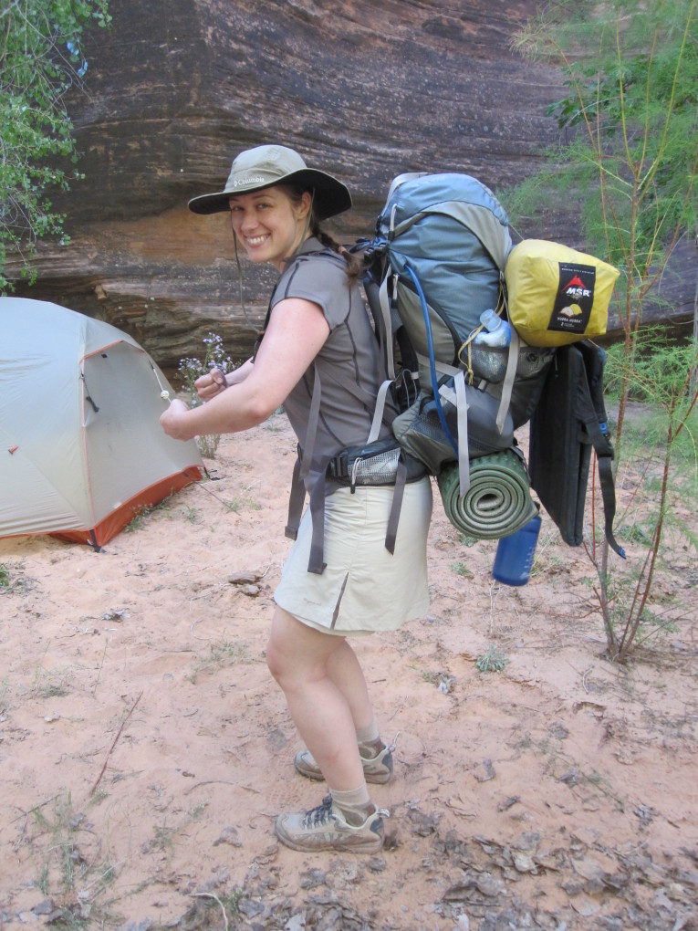
![[kc/1595.jpg]](kc/1595.jpg.medium)
|
Kelly in her hiking skirt ready to go. |
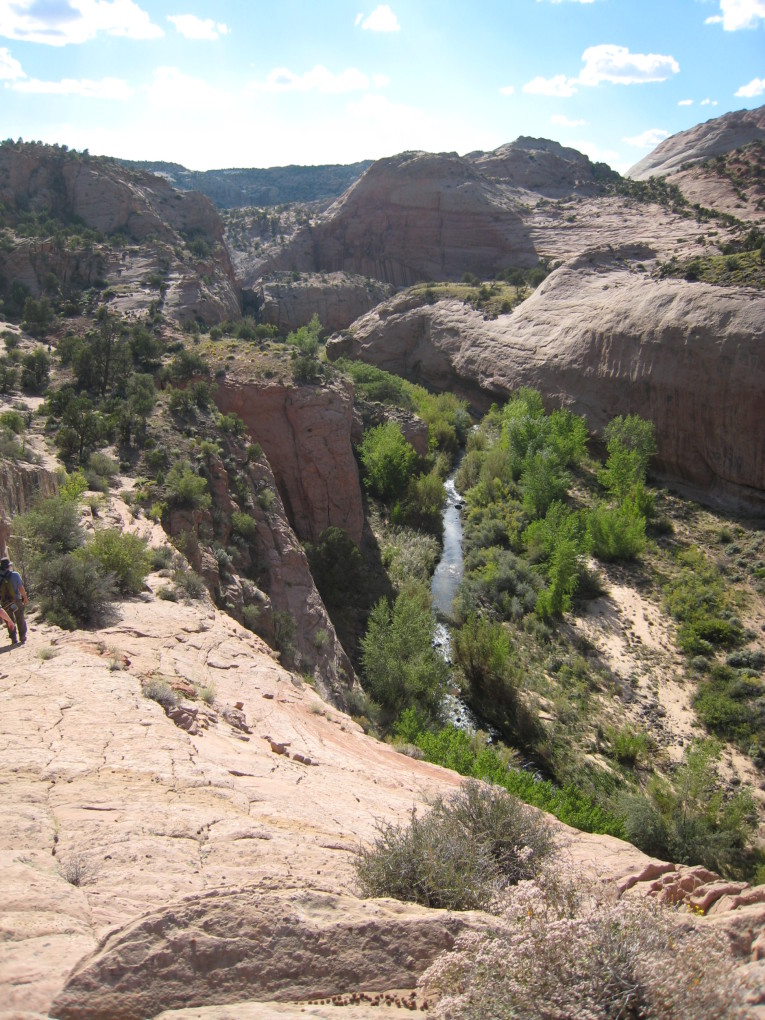
The rest of us (me, Erin, Pete, Ben, and Russ) would hike to the Escalante River to see the water and the sights along the way. The basic route would be to climb out of Sleepy Hollow and then skirt the mesa to the south along its eastern side.
![[rp/20100914-02333.jpg]](rp/20100914-02333.jpg.medium)
|
The standard ascent out of Sleepy Hollow. |
![[et/5146.jpg]](et/5146.jpg.medium)
|
Flowers with the benches of the Escalante basin beyond. I believe that is Navajo Mountain peeking over the horizon. |
![[et/5147.jpg]](et/5147.jpg.medium)
|
Ben, Russ, Pete, and me enjoying the view of Brigham Tea Bench, the flat area between The Gulch and the mesa. |
![[bm/3849.jpg]](bm/3849.jpg.medium)
|
Looking towards the Escalante from atop the rock. Our route would be to skirt the base of the rock, pretty much straight ahead. |
![[rp/20100914-02355.jpg]](rp/20100914-02355.jpg.medium)
|
Purple flowers hiding under a bush. |
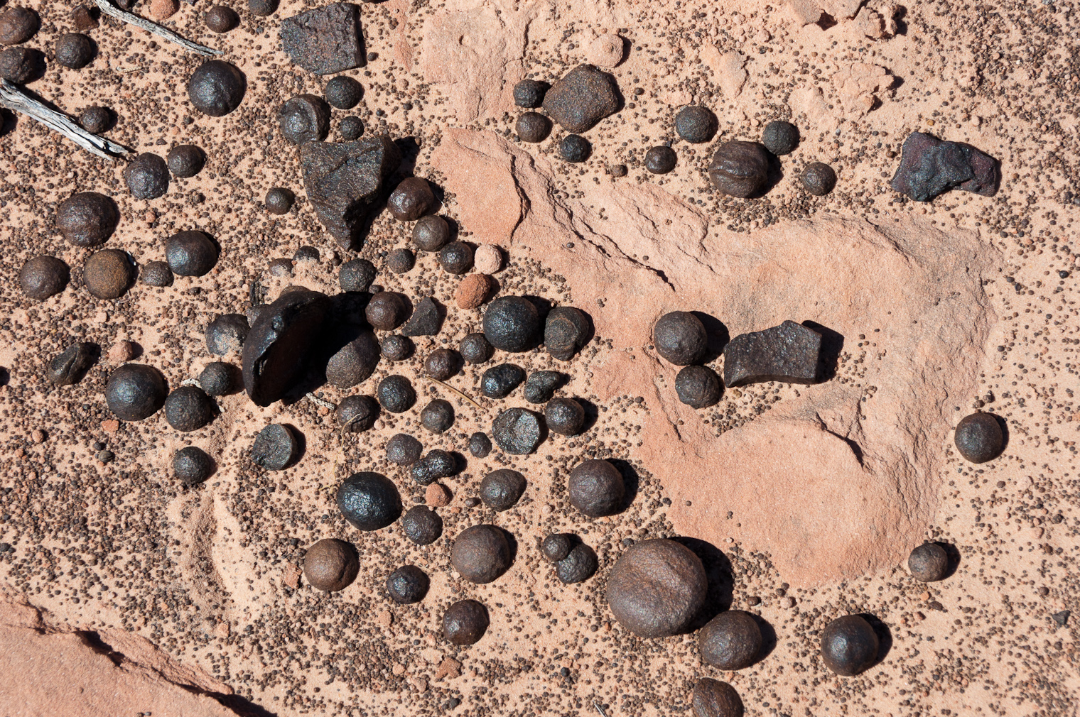
![[rp/20100914-02358.jpg]](rp/20100914-02358.jpg.medium)
|
Russ admiring a huge deposit of moqui marbles. I had seen this dark area on Google Earth and wondered what it was, since it was oddly placed to be water. |
![[rp/20100914-02370.jpg]](rp/20100914-02370.jpg.medium)
|
Moqui marbles detail. |
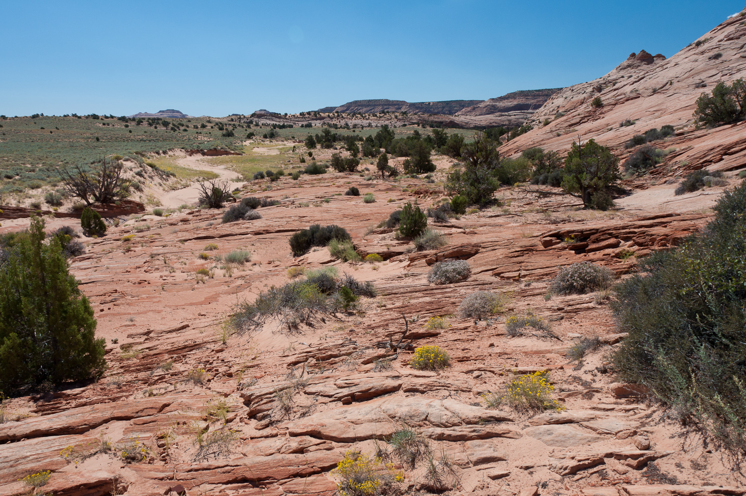
![[rp/20100914-02373.jpg]](rp/20100914-02373.jpg.medium)
|
Continuing on towards the Escalante. |
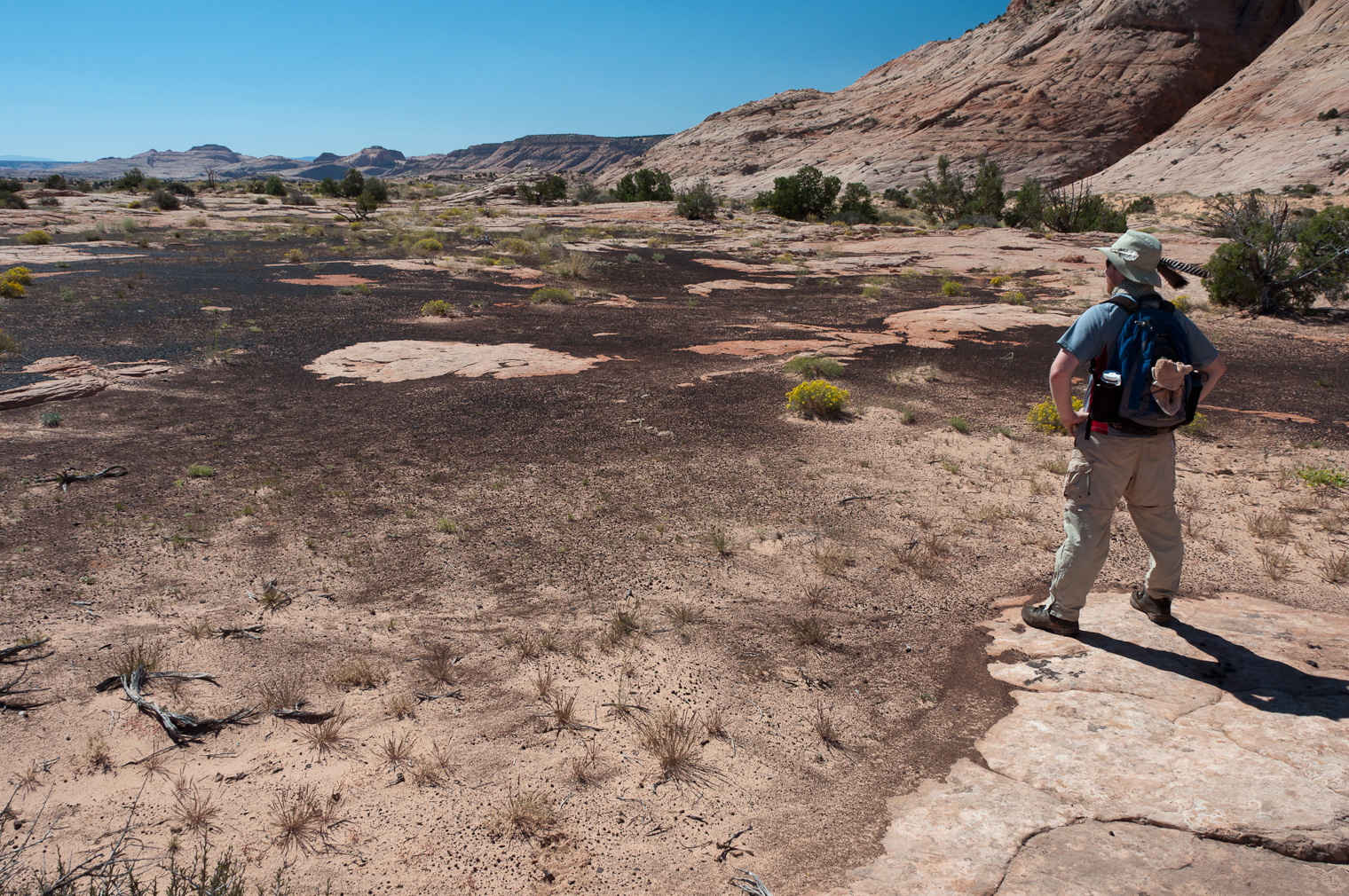
![[pw/0976.jpg]](pw/0976.jpg.medium)
|
The south side of the mesa we would circumnavigate before the day was over. |
It was a long and rather tedious hike, with lots of slogging through sand in the hot sun. Finally, we made it to the old cabin which marked the descent to the river.
![[rp/20100914-02380.jpg]](rp/20100914-02380.jpg.medium)
|
The cabin. It made creepy noises in the wind. |
We were quite hot, tired, and hungry by the time we reached the canyon bottom. Unfortunately, the area was densely overgrown and the open areas were very hot in the sun, so it would take some effort to find a spot for lunch. We first thrashed our way to the lunch spot from five years ago; this had changed and was now overgrown and full of cobwebs. No good, and I had left the machete at home.
After that, we found our way to the river. It was a pretty miserable twenty minutes or so – I changed into water shoes, crossed, and thrashed around for a while trying to find a lunch spot with no luck (everything was either overgrown or sunny), while the others waited, unsure if crossing was the right thing to do. Finally, I (or perhaps Ben) found some sloping ledges just a few feet from where I’d had come ashore. They actually made for a pretty pleasant lunch spot.
After lunch there was time for some bathing/playing and exploring.
![[bm/3857.jpg]](bm/3857.jpg.medium)
|
The Escalante River. Our lunch spot is on the ledges just out of view to the left. |
![[pw/0981.jpg]](pw/0981.jpg.medium)
|
Erin and me. Readers should be aware that I’m nude from the waist down. This caused great consternation among other members of the party. |
Pete adds: Lunch was quick and then we played in the river, which was a lot of fun and felt fantastic. Getting the alternating layers of SPF50 and dirt off felt fantastic. The water was cold, but not as cold as Boulder Creek had been. Reid also made an excellent showing, traipsing downstream in sunglasses, a t-shirt and water shoes. It was a good photo opportunity. The rest of us kept our clothes on, except when changing.
![[rp/20100914-02385.jpg]](rp/20100914-02385.jpg.medium)
|
This crack was super intriguing. The pool in front of it was chest deep with spots of quicksand. |
![[rp/20100914-02400.jpg]](rp/20100914-02400.jpg.medium)
|
It turned out one could travel all the way through the crack to the other side of the meander. It was pretty awesome. |
After a few hours at the river, we dried off, packed up, and headed for home. The plan was to circumnavigate the mesa, returning home around the west side; I suggested it as a “shortcut” in order to avoid the lengthy sand walking on the east side.
![[rp/20100914-02416.jpg]](rp/20100914-02416.jpg.medium)
|
I believe this is a sacred datura. |
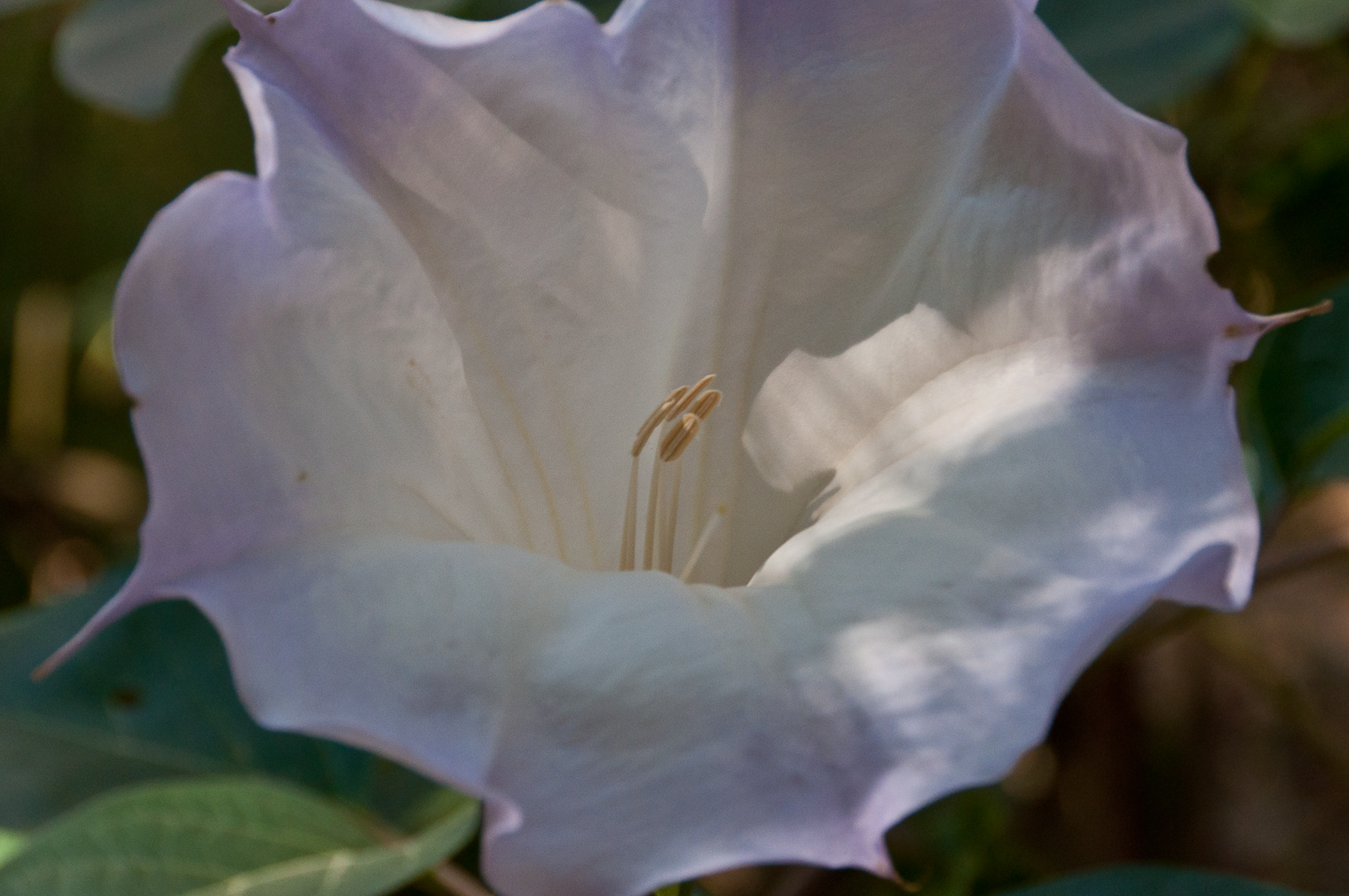
![[rp/20100914-02430.jpg]](rp/20100914-02430.jpg.medium)
|
Onward. To return to camp, we would go left to continue the circumnavigation. |
![[bm/3865.jpg]](bm/3865.jpg.medium)
|
Ben: “The cobblestones where the river used to be were really awesome. They seemed so out of place on the rocks and there were tons of them.” (This photo is looking back towards the Escalante River.) |
There was one key obstacle: getting down the 100-foot cliff that blocked the way to Boulder Creek. I had done this route before. The crux is an extremely improbable-looking ramp which looks truly impossible, but in reality is a relatively straightforward though airy-feeling Class 3+ downclimb with minimal objective risk.
We took our time and everyone made it down great. I was proud of my people.
Pete adds: There was a long, reasonably wide, not particularly steep ramp down on our trek back to camp. It seemed that the drop off to the right was anywhere from 100 to 200 feet down to the creek, with some ledges, which scared the hell out of me. I was the last to descend, but despite seeing the rest of the group go down without a problem I froze up at the thought of plummeting to my death. After some encouragement I managed to make it down, but what was probably a couple of minutes of freezing up and slowly descending felt like a lifetime. I’m not sure when I’ve ever been that scared, but looking back at the experience I’m not sure why it was even a problem.
![[bm/3867.jpg]](bm/3867.jpg.medium)
|
Boulder Creek overlook. The way down is the nearest shadowed ramp on the left, believe it or not. |
The next step was to thrash though the brush along the creek for a bit and then ascend back up 150 feet before dropping down again immediately into the side canyon which went around the southwest corner of the mesa.
I believe it was around this time when folks began to question my claims of shortcutness with particular vigor.
![[rp/20100914-02439.jpg]](rp/20100914-02439.jpg.medium)
|
A fun whorl of rock. |
![[rp/20100914-02461.jpg]](rp/20100914-02461.jpg.medium)
|
Side canyon which took us around the southwest side of the mesa. |
After climbing out the head of the side canyon, we wound our way over slickrock to the wash with the pools (that we had followed to Boulder Creek on Day 2) and followed that to the pass with Sleepy Hollow.
![[rp/20100914-02485.jpg]](rp/20100914-02485.jpg.medium)
|
Navajo Sandstone rocks as the light begins to yellow for sunset. |
![[rp/20100914-02491.jpg]](rp/20100914-02491.jpg.medium)
|
Late afternoon at the pass between Sleepy Hollow and Boulder Creek, looking east over Sleep Hollow and The Gulch. |
Pete adds: We got back to camp maybe a bit before sunset, incredibly tired and once again dirty after our river play only a few hours earlier. Group dinner from Russ was welcome and filling.
Reid had earlier said that we’d do the “mountain” tomorrow (butte), but later decided it would be a day of rest. Apparently I wasn’t the only one tired and sore and willing to say it. Once we’d gotten back to camp and stopped for more than a few minutes, I was more sore than I can recall ever being before. Walking around camp was difficult and ibuprofen was consumed in great quantity.
Russ adds: I did a load of laundry in the river and it was really great to have clean clothes as I was pretty grungy by that time in the trip. Also the shortcut at the end of the day that involved the descent off of sheer cliffs - not so good for scared-of-heights guys like myself. Thankfully I had the steady Erin to help me get to the bottom of the cliff. Little did I know but in two days I would be in mortal fear again on top of Point 6167.
![[rp/20100914-02516.jpg]](rp/20100914-02516.jpg.medium)
|
This terrifying bug we found wandering outside camp is about two inches long; it’s a Jerusalem Cricket or Child of the Earth. They can grow up to 14" long and sometimes eat rattlesnakes.* |
Ben adds: Finding this bug again was fortunate for me. We had seen one on a previous trip (Stevens Canyon – see photo 23) but failed to get a good enough photo to correctly identify it. Finding that it is referred to as “Child of the earth” is funny since I had decided it was some sort of alien species. I believe the method of discovery was not so fortunate for the insect though. This method was Reid peeing wildly, I assume it was wildly, unknowingly in the insect’s general location and said insect running for its life.
Please continue reading on Day 6.
* This claim is false.