![[An adorable red squirrel]](splash.jpeg)
Sioux-Hustler Trail 2005
with the lovely Erin Tatge
In August-September 2005, Erin Tatge and Reid Priedhorsky went on a four-day backpacking adventure in the Boundary Waters Canoe Area Wilderness in northern Minnesota. Welcome to our trip report!
Update! Erin and Reid returned to this trail in 2007: that fine trip report is online too.
This trip report is structured around the fine brochure given to us by the Forest Service when we picked up our permit. We’ve reproduced the text. (As best I (Reid) can figure, this is OK. The brochure bears no copyright notice, and it appears to be a government – i.e. non-copyrightable – publication anyway. If you are or speak for the copyright holder, however, please let me know immediately and I will be happy to remove it or work out terms which are satisfactory.) The Forest Service is apparently discontinuing handing out the brochures.
There are three voices in this report. Reid’s is marked with Roman text on a blue background: Reid writes like this. Erin’s is marked with Roman text on red: Erin writes like this. The brochure text is italic with indented margins.
Tuesday, August 30
We left Minneapolis around noon, after packing up the car in the morning. Had an uneventful drive to Duluth, where we spent some time in a museum about the shipping industry before meeting up with Reid’s friend Katie Esse for some supper. Then it was a little more driving before stopping at a Forest Service campground off Highway 1 for the night.
Wednesday, August 31
We continued to Ely, where we picked up our permit at the ranger station and headed out to the trailhead, about an hour’s drive along the “Echo Trail”.
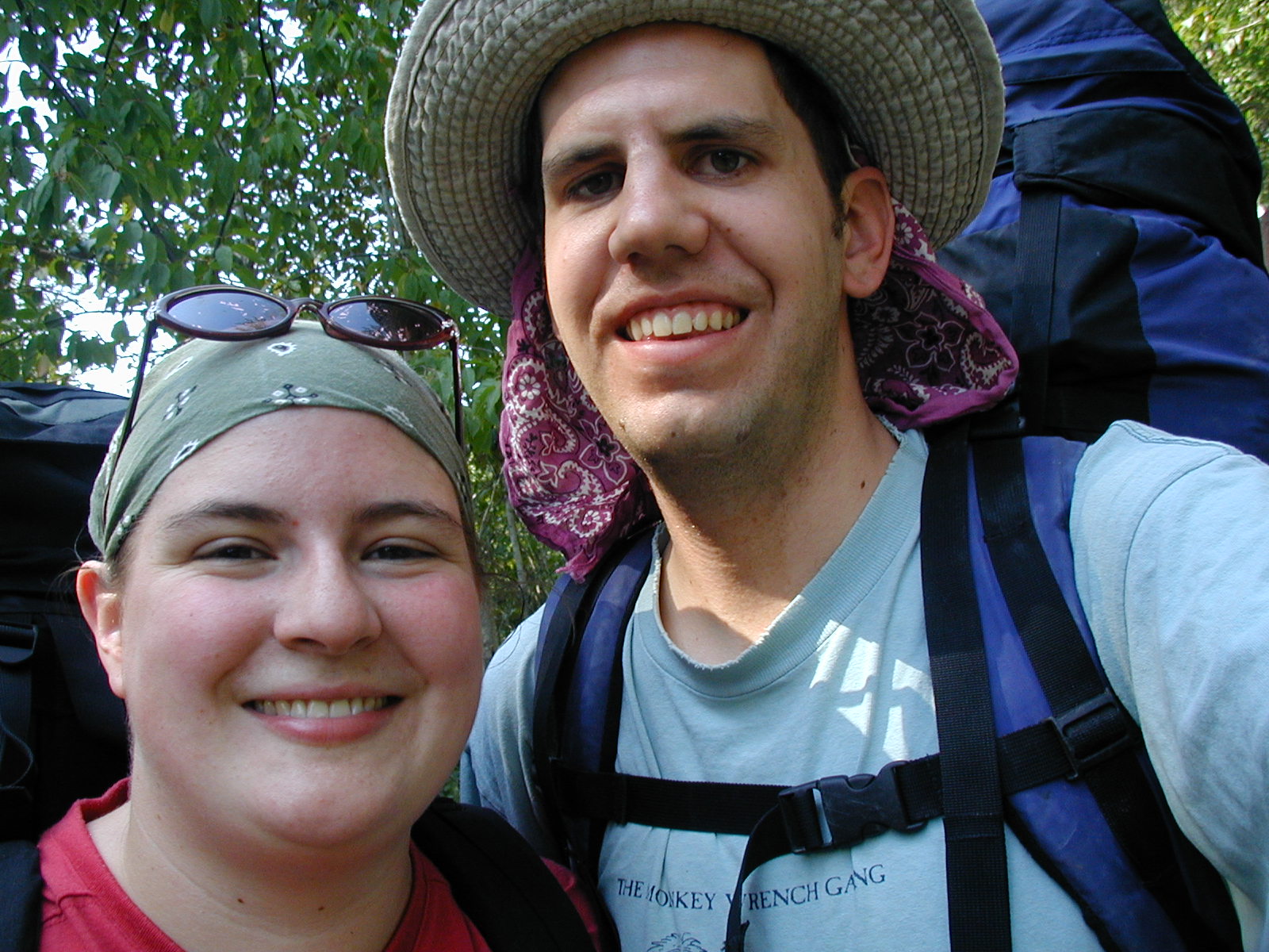
![[photos/p8310003.jpg]](photos/p8310003.jpg.medium)
|
Erin and myself at the trailhead. |
General Trail Information
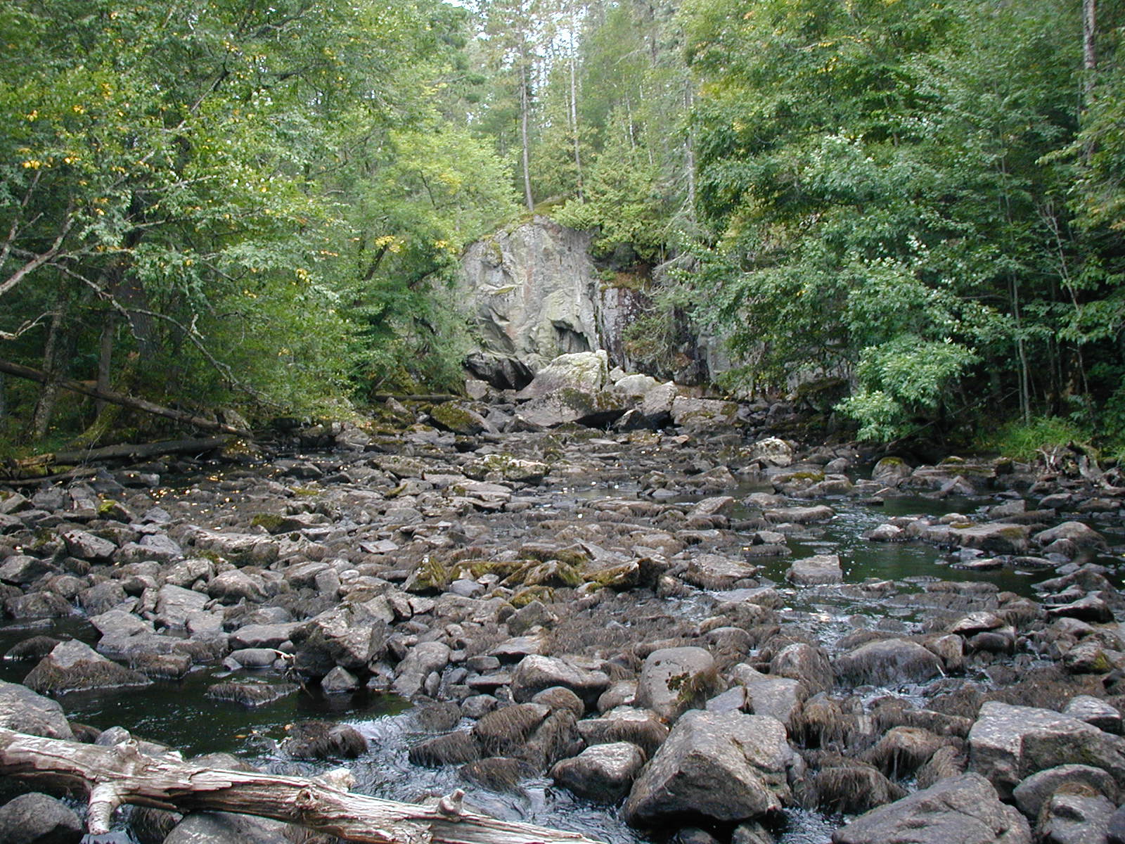
The trail is approximately a 32-mile loop that is minimally maintained. There is a need for preparedness in route-finding under adverse conditions for those who enter this wilderness trail.
It is marked by rock cairns and tree blazes; however, there are other signs to watch for – sawn-cut log ends and tree roots that have been worn bare by foot traffic. Even with these signs it is possible to lose the trail or encounter a large blown-down jumble of trees.
![[photos/img_0012.jpg]](photos/img_0012.jpg)
|
Adorable fern. These were ubiquitous along the trail.
Photo by Erin Tatge. |
To find the trail, the best course of action is to post someone where you last knew you were on the trail while the rest of your party circles the area out in front or beyond the jumble to search for the trail tread. Don’t forget that the last place you think you were on the trail might already be off the trail. False trails are sometimes created by others who have made the same wrong turn that you did – so you may have to check for the true trail somewhere behind you.
Other areas to be alert for is around beaver dams. [Yeah, no kidding.] The trail doesn’t always continue where the dams end (beavers keep changing the dams). Usually there will be a discernible reroute leading you to the trail. Keep your eyes open and you should be able to find it.
The route-finding was extremely difficult around beaver dams. Typically, the trail would simply peter out, and one would look around and see a beaver dam, cross that, and then stumble around a little until finding the trail. I didn’t see any “discernable reroutes”.
Following is a brief description of the trail – divided into four sections – with approximate distances listed in miles.
We modified the brochure’s section breaks to line up with our four hiking days.
As someone who had never been to the Boundary Waters before, I think the thing that was the most pleasant surprise for me was the privies. They didn’t have walls around them, but they had something to sit on over a pre-dug hole. How very much nicer than do-it-yourself holes!!!
Not to mention my crappy orange plastic trowel. I am still looking for a nice titanium trowel.
Hiking Day 1
Trail head to Elm Portage (3 1/4 miles)
Elm Portage to West Cut Across (2 3/4 miles)
Cut Across to Devil’s Cascade (3/4)
The first section of the trail is a popular day hike to Devil’s Cascade or an impressive first leg of a multi-day trip. The rich diversity of the region presents itself as the trail progresses from old road to meandering grassland path to rocky woodland trail.
![[photos/img_0013.jpg]](photos/img_0013.jpg)
|
Forest scene typical of the first couple of days of hiking.
Photo by Erin Tatge. |
Loosen your legs during the first half-mile cruise along the old road. At the first beaver dam, look for a sharp left turn onto the challenging single track that is characteristic of the trail and say “goodbye” to civilization. Follow the meandering trail corridor for a mile as it winds through waist-high brush and across hidden streams. Don’t be deceived by straying animal trails! Stay close to the edge of the first open pond, then watch the transition of the landscape as the trail climbs out of the wet lowland region and into the forested uplands.
Erin fell in at the first beaver dam, which, as it turned out, was the most challenging. The process at these dams is to just walk across the crest, and this one was particularly fresh and very muddy. The water was lapping at the top of the dam. Most were grassy, dry, and pretty solid.
At our first beaver dam crossing, I was leading the way. I walked on, watching the muddy top of the dam. The water to the right looked pretty deep, and the left side had a drop-off of several feet. Part way across the dam, I stepped into some very mucky mud on the right side, sinking in to mid-thigh. After a momentary thought of “I’m never going to get out of this!” I started to pull myself up, pushing on the mud to the left of me. It took some pulling, but I made it out of the mud, boot intact. It did give me a whole new appreciation for what I must have gone through when I got stuck in the mud that Christmas many years ago – that stuff’s hard to pull out of!
Traversing the rolling hills for the next two miles gives a good indication of what much of the trail is like. The distant sound of rumbling water signals the arrival of an excellent resting spot – the rapids of the Little Indian-Sioux River at Elm Portage.
![[photos/p8310004.jpg]](photos/p8310004.jpg.medium)
|
Erin hiking through the woods. Typically, the trail was nowhere near this good. |
Somewhere around here it started to sprinkle – enough for us to talk about getting rain gear out, but not enough to actually do it.
After leaving the rapids, the trail glides alongside the slow-moving river for a mile before turning north. Expect and unavoidable and challenging beaver dam crossing before coasting out of the remaining 1 1/2 miles of the section on long forested straight-aways. Crossing the Lower Pawness/Shell Lake portage foretells of the upcoming intersection with the Cut Across and day-hike destination of Devil’s Cascade.
Continuing on from the intersection with the cut across, the trail heads northwest for 1/2 mile – gaining a high point on a saddle between two ridges. Ta that point turn left and head due west while beginning a 1/4 mile descent to the devil’s Cascade area. After the descent levels out keep a close watch. The main trail takes a sharp right turn as it heads north towards Heritage Creek – before it actually gets to the devil’s Cascade area. It is well-worth the short side trip to see the Devil’s Cascade area. Continue west from the main trail intersection, then straight ahead a short distance until you cross the devil’s Cascade portage trail, and finally arrive at the campsite which is at an overlook at the top of the cascade. At this point you’re standing 80 to 100 feet above the main falls in the cascade. Look N/NW and you’ll get a great view down the gorge, which the Little Indian-Sioux River follows to Loon Lake.
On the way to the campsite, we took a brief wrong turn down the spur trail to the privy. Figuring that the campsite was close but not quite there we moved on to it quickly and set up camp just as it got dark and started to rain a little more. I managed to make the wettest fire I ever have while Reid set up the tent. After dark, the sky cleared up for some lovely star-gazing and a dim glow of the the northern lights.
![[photos/img_0002.jpg]](photos/img_0002.jpg)
|
Peering down into the Devil’s Cascade gorge from camp.
Photo by Erin Tatge. |
![[photos/p9010008.jpg]](photos/p9010008.jpg.medium)
|
Above Devil’s Cascade, where we fetched water. |
An interesting thing about this section is that the trail leading to the campsite is much, much larger and clearer than the actual main trail, which is a faint track leading off into the words.
Supper was macaroni and cheese with peas. There were quite bold mice in this campsite, but they were very cute. We also had several frogs and toads hopping around camp after sunset.
Thursday, September 1 (Day 2)
Devil’s Cascade to Beaver Dam (2 3/4)
Beaver dam to Heritage/Loon Portage (3/4)
Heritage/Loon Portage to Pageant Lake Camp (2)
Pageant Lake Camp to Range Line Creek (1 1/2)
In the morning we heard what sounded like a small group portaging nearby, but we didn’t see anyone. It was still dreary and drizzly today – Reid started out with his old wet socks, but I moved on to my second (dry) pair. Which theory will win out?
The underbrush was still pretty wet from the rain yesterday and overnight, and it looked to me like we were in for more. My boots were still wet, too. I reasoned that even if I started with dry socks, pretty soon I’d have two wet pairs instead of one wet and one dry.
Some of the most beautiful sights on the whole trail are contained in this section; the Heritage Creek crossing, the campsite at Pageant Lake, and the overlook of the Pageant Creek crossing.
In my opinion, the western section of the loop and the Cut Across are the best parts of the trail.
From the Devil’s Cascade spur intersection you’ll head north on the main trail as it traverses the east side slope of the river gorge (never more than 1/4 mile from the river). The slope is heavily wooded, but there are a few chances to peek out at the river 100 feet below. [We found that almost all the views advertised in the brochure were pretty well obscured by trees this time of year.] After about 1 1/4 miles you’ll leave the side slope and walk up a small coulee. Turn left at the top of the coulee before reaching the marsh; the trail heads NE over a rock top for 3/4 of a mile.
![[photos/p9010014.jpg]](photos/p9010014.jpg.medium)
|
Erin crossing a beaver dam. |
![[photos/p9010016.jpg]](photos/p9010016.jpg.medium)
|
Erin crossing a different beaver dam. |
Sliding off the rock top the trail sweeps around the west side of another marshy area, briefly gains solid ground before arriving at a long beaver dam. Carefully work your way across the top of the dam to the other side, where the trail follows solid, higher ground. About 3/4 miles after the dam-crossing you will be intersection the Heritage Lake/East Bay of Loon Lake Portage. Soon after the portage (1/2 mile) you’ll reach Heritage Creek – where the trail crosses on a downed, large, old-growth red pine.
Fortunately, the water was low enough that we could step across on rocks. The red pine is about 8 or 10 feet above the water and very slippery looking, especially on such a soggy and drizzly day.
The trail continues generally north for the next mile. First it’s up and over one ridge hill, a quick drop into – and climb out of – a gully, then up to the top of another ridge hill. Here the trail begins to drop before rounding quickly to an eastward direction. When you’re about even with the west end of Pageant Lake, the trail crosses a small stream. After rising from the stream-crossing, watch for the Pageant Lake campsite spur trail on your left.
A very nice view, but cold and windy on a day like this. We stopped for lunch, bundled up, and then moved on.
![[photos/p9010020.jpg]](photos/p9010020.jpg.medium)
|
Me shivering at the Pageant Lake campsite. John Garbe and I camped here three years ago. It is a great campsite and very remote. Pageant Lake is inaccessible to canoes.
Photo by Erin
Tatge. |
From the campsite spur trail, the main trail heads generally eastward, parallel to the south shore of the lake. As you continue, the trail gradually pulls away from Pageant Lake and turns southward at the top of a steep rise that overlooks Pageant Creek and a series of beaver dams along it’s course. Descend straight down the hill and cross the creek directly below.
Once across Pageant Creek the trail continues straight ahead and abruptly climbs 4 to 6 feet out of creek level. Again on solid ground, the trail rises up the toe of a rock ridge, first heading southward, then swinging somewhat eastward to Range Line Creek as it dances northward. A view of the north end of Range Link Lake will open to your right a short distance past the creek.
After crossing Range Line Creek, go another 1/4 mile and keep your eyes open for the easily missed campsite spur trail. Range line is a nice campsite, but seldom used by hikers and is not easily accessible by canoe.
Our next night’s stop. It continued drizzling all day, and this campsite, while very pretty on a point looking out into the lake and some little islands, was WINDY. It took a little work to set up a fly, but we were rewarded with enchiladas and an early night.
I would disagree with the brochure’s assessment – this is a crummy campsite. It is a fabulous view, though, and again feels very remote. It looked to me like the canoe campsite (marked on the map) was nicer; the next time I do this trail, I’d like to try to find a way out to it. The privy at this campsite is hard to find – the extremely faint trail starts on your left about 30 paces back towards the main trail. (I can’t take credit for this, though – Erin found it.)
![[photos/p9020022.jpg]](photos/p9020022.jpg.medium)
|
View from Range Line campsite. |
![[photos/p9020024.jpg]](photos/p9020024.jpg.medium)
|
Setting up camp at Range Line. |
Friday, September 2 (Day 3)
Range Line Creek to 3 Sentinels (1 1/4)
3 Sentinels to Hustler/Oyster Portage (2 1/4)
Hustler/Oyster Portage to S. Emerald Camp (1 1/2)
S. Emerald Camp to bend at Shahola (3/4)
Shahola Creek to Agawato (1 1/2)
At this point, we both had wet boots that didn’t dry out at all overnight. Socks were aired, but nothing was less than moist by morning. Reid stayed with the wet socks, and I put on my less-wet pair of socks, hanging all the others off my pack and hoping for the best.
Watch for wintergreen’s scarlet berries peeking out beneath its ground-hugging evergreen foliage along this section. Look for saplings with their tops broken or frayed off overhead by moose feeding in the winter using the trail as a highway.
Based on this description, we managed to identify wintergreen, but we weren’t sure if it was edible raw (I was entertaining ideas of tea), so we just smelled it.
The main trail continues through a boggy area – a good test of your waterproof boots. [At this point, does it matter? And for the record, this “boggy area” was much drier than many other sections of the trail.] About a mile down the trail are three old growth white pines along the trail side. Often referred to as the three sentinels, these trees are 200+ years old. Takes some time here to look around and imagine what these giants have lived through.
![[photos/p9020025.jpg]](photos/p9020025.jpg.medium)
|
A strange fungus at the foot of the “Three Sentinels”. One of the three big trees is now a huge dead snag. |
One-half mile past the Sentinels begins a long descent from the ridge to a bog crossing at the north end of Hustler Lake. Here you’ll find an old log bridge to cross; [I started to deveolp a real talent – I crossed the bridge fine, but as soon as I’d stepped off, mis-judged a landing area and fell over. In the water. And felt like a fool.] a short distance further is a rock hop crossing at the Posse Lake drainage. This is a good place to top off your water – the next easily accessible water is at the east end of Hustler Lake (approximately 2 miles away). Just past Posse Lake crossing is the north Hustler Lake campsite – it is on a slope, but useable.
The sun came out about this time – we found a rock top to have some lunch, and stretched out all socks and shoes and selves for some sunning and drying. Reid took a short hike down the trail for a pit stop, and I acted like a reptile in the sun. A few minutes later, I heard dogs barking, and then voices. Out of the woods appeared 2 labs and a couple. I chatted with them a while – they were canoeists on a day hike to stretch their legs. While telling them about our trip, I referenced Reid, and they said, “Oh, yeah, we saw him on our way in. Caught him in something of a compromising position.” They thought it was very funny, and in fact had just changed clothes before coming across Reid – they were worried at first that he’d seen them!
After lunch, I needed a pit stop. Since we hadn’t seen anyone in two days, and travel through the woods was pretty difficult, I decided I didn’t need to make much effort for privacy. I went back down the trail a little ways and found a spot maybe 10 feet off the trail under a tree. I had dug a hole and squatted down to do my business when two canids came bursting out of the bushes. My first thought was wolves, but that didn’t really compute and I realized they were plain old dogs – which meant people were shortly behind. Sure enough, a man and a woman came around the bend of the trail. I greeted them with “Howdy!” and they replied as they walked by that they weren’t expecting to see anyone either! Strangely, it wasn’t as embarrassing as I thought it would be when I’d envisioned this scenario in the past. I thought it was quite funny too.
The next 1 1/2 mile section, to east Hustler Lake campsite, is dry with some ridges to climb. As you hike along the ridges watch for glimpses of Hustler Lake through the trees. The east Hustler campsite spur trail, which is marked by cairns, is on a trail bend as you start to descend the ridge. This campsite is frequented by paddlers using the Hustler/Oyster Lake portage. A little further on you’ll come to the Weeny Lake drainage – which is just a step across, and the Hustler Lake/Oyster Lake portage – which intersects at 90 degrees and is well-defined.
![[photos/p9020030.jpg]](photos/p9020030.jpg.medium)
|
This tree was broken over the trail. It didn’t appear to have any signs of rot or poor health. |
Continue 1 1/2 miles south to the Emerald Lake north campsite. The camp trail follows the shoreline of the bay to camp – marked, but hard to find. The camp is seldom used by hikers and well used by paddlers. Keep on walking south for another 3/4 miles to the Emerald Lake south campsite spur trail. This spur trail heads west and descends from the ridge crest for almost 1/4 mile. It is seldom used by paddlers.
It is only 1 1/4 miles further to the Shahola/Cut Across area, but first you’ll cross the creek on an impressive beaver dam and climb up the hill to the ridge crest. At this point you’ll see where the main trail turns west and intersects with the east end of the cut across.
At Shahola Creek, the crossing started out uneventfully. The trail petered out, as usual, and we found ourselves at the end of an extremely large and certainly very impressive beaver dam. We spent a few minutes finding our way across – I thought that one of the small trees in the middle looked familiar – but once on the other side, a very promising trail petered out almost immediately. There were a number of tracks at the end of the dam, but none went anywhere.
We spent quite a while stumbling around the woods and fields near the end of the beaver dam. There were many false leads but no trace of the trail. Finally, I wandered back onto the dam and looked around; downstream, there was another, much smaller, beaver dam. I made my way the hundred yards along the edge of the bog and discovered, finally, cut logs marking the actual trail. It had been a very frustrating hour or so. We pumped some water and followed the trail up the hill.
![[photos/img_0027.jpg]](photos/img_0027.jpg.medium)
|
View from the beaver dam where we got lost. |
![[photos/img_0028.jpg]](photos/img_0028.jpg.medium)
|
Me trying to get un-lost at Shahola Creek. |
At the top of the hill is a sharp right turn marked with a cairn. This was once a fork, with one trail, now abandoned, traveling south five or six miles through the woods to Meander Lake. Now, there was no trace it. We went west on the maintained trail. One thing I find interesting, compared to backpacking in the canyon country, is the degree of maintenance required. The Sioux-Hustler Trail is cleared every year or two, and it is still nearly overgrown and blocked by hundreds of downed trees. On the other hand, I’ve been on trails in Utah that haven’t seen maintenance in half a century which are perfectly passable.
![[photos/p9020032.jpg]](photos/p9020032.jpg.medium)
|
Trail fungus. |
Heading west from Shahola Creek, the trail continues west along a ridge for a mile before descending into a saturated lowland depressing. In the spring watch for bog flowers such as the Minnesota state flower – the delicate Lady Slipper. While catching your breath at the top of the next rise, start looking for the double blazed trees and sawn logs that mark the spur trail to the secluded campsite at Agawato Lake. The campsite sits on a small bluff above the lake.
What a gorgeous campsite. Having such good weather surely helped, but the lake was perfectly calm, the campsite was a flat area with a tent pad and a flat rock with a fire grate; there was a small hill down and another level area covered in moss; another small hill down and you were at the rocky lakeshore. Oh, yeah, and you can’t forget that the privy was in the middle of the spur trail to the campsite.
That night we roasted a lot of socks and shoes by our fire, saw a wonderful sunset, looked at the stars, and saw an impressive display of northern lights. It started as a blue glow on the horizon, and then we started to see streams of light shining up into the sky. After a few minutes, the streams started moving around, appearing and disappearing over a course of a minute or so each. The glow on the horizon spread up into the sky, with bright patches that started moving quickly side to side. At this point we were also having rapidly appearing and disappearing streams of light, and flashes so high in the sky they were almost straight overhead.
![[photos/img_0041.jpg]](photos/img_0041.jpg.medium)
|
Sunset at Agawato Lake. |
Saturday, September 3 (Day 4)
Agawato - Shell/Little Shell portage (3 1/4)
Shell/Little Shell portage to Shell/Heritage Portage (1)
Shell/Heritage Portage to West Cut Across (1 1/2)
![[photos/img_0054.jpg]](photos/img_0054.jpg.medium)
|
Misty morning over Agawato Lake on the last day. |
![[photos/img_0053.jpg]](photos/img_0053.jpg.medium)
|
More misty morning. |
When we woke up in the morning, not only did everyone have dry socks, but the lake was covered in an amazing layer of fog – we got up just in time to watch it dissipate over 20 minutes or so.
This day was punctuated by seeing a lot of other people – no one else on the trail until we finished the loop and were on our way back out, but many canoeists on the lakes we walked past. This was our longest hiking day, but felt easy.
The sharp bend in the trail at Shahola Creek signifies the start of a wonderful and diverse six-mile section known as the “Cut Across.” Look forward to scenic lakeside hiking, challenging climbs and the most spectacular lookout points east of Devil’s Cascade. The section is also known for frequent moose sightings in the cattail swamps that edge many of the small lakes.
We saw no moose. Enough moose droppings to build a life-size replica, but no live moose.
Immediately after the Agawato campsite spur trail, the path descends steeply to another bog and rises again just as quickly on one of the steepest pitches along the trail. Within 1/4 mile expect a sharp right turn heading down along a bluff, followed immediately by a short scrambling climb. The sinuous trail requires full attention through this section. A series of vista points looking south over Dogfish Lake and west across Shell Lake highlight the next mile before the trail descends to a splendid lakeshore stretch along Little Shell Lake.
![[photos/img_0033.jpg]](photos/img_0033.jpg.medium)
|
Rocky areas like this were common during the last couple of days. Note the cairn in the lower right hand corner. |
Several ideal rest spots are scattered along the shoreline all the way to the Shell/Little Shell portage. A popular campsite is located on the peninsula on the west side of the portage. Scramble south along the Shell Lake shoreline to reach the spacious campsite. Continuing west from the portage, the path climbs steadily towards the highest point along the entire trail – an excellent panoramic view looking south to Shell Lake and Con Island.
Again, there wasn’t much of a view. We did see a trail heading towards Shell Lake just as we came into the open rocky area; I suspect this goes to the campsite at the lake which is marked on the map. Another interesting thing along this stretch is the cairns. For most of the trail, one rock on top of another qualifies as a cairn; however, in this section there were frequent, towering piles of rocks.
![[photos/img_0062.jpg]](photos/img_0062.jpg.medium)
|
Me consulting the map near Shell Lake. |
The hill drops off after the vista point, quickly descending to the Shell/Heritage portage and another beaver dam crossing. From the west side of the dam, the trail turns sharply to the left and begins a steady SW ascent up to the west Cut Across intersection. This final 1 1/2 miles of the section is fast and straight. The trail eventually arrives at a T, with the Devil’s Cascade being a short trip to the northwest and the trailhead six miles to the southeast. The last 6 miles of the trail back-tracks over the Little Indian-Sioux River section; a pleasant way to end your hiking adventure.
On the way out, I was nervous about crossing the beaver dam I had initially fallen on. Reid went ahead and scouted out to see if there was a better way – it turns out that there was a new and muddy beaver dam that we had crossed before, but a little way downstream there was a grassy, more solid area that was a snap to cross. It was nice to end the hike without a mud bath.
After hiking out, we drove back to Ely and looked for a motel room. Of course, it was labor day weekend. To their credit, none of the motels we talked to flat out laughed in our faces. The only room we could find was a room with 3 queen beds. It seemed excessive somehow, so we found a Forest Service campground down the road.
Sunday, September 4
We drove into town for a few groceries, and saw the headlines that Rehnquist had died. A quick stop at the ranger station to buy a map, and they were amazed that a) we had hiked the Sioux-Hustler trail and b) that we had enjoyed it. They had gotten some complaints about the trail being hard to find and full of deadfall. Both of those things were true at times, but it’s a wilderness area, people. What do you expect?
To their credit, the Powwow and Snowbank Trails are also in the BWCAW, and they are much less challenging.
We left Ely and headed out to see Reid’s sister Anna at Outward Bound. We ate lunch with a bunch of her co-workers and spent the afternoon peppering her with questions about her job and the organization.
Monday, September 5
Time to go home...